
1978 Chamber of Commerce Map of Sanibel and Captiva Islands, Florida

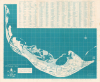
The Enchanting Islands Sanibel and Captiva / map of Sanibel and Captiva Islands.
Pioneering Conservation and Development.
$300.00
Choose a Collection:
This Item
Enquire
Pioneering Conservation and Development.
This is a c. 1978 folding map of Sanibel and Captiva Islands published by the local Chamber of Commerce. It presents the islands at a critical time, after Sanibel had incorporated as a city and had laid out a bold plan to preserve the area's ecology and limit development.A Closer Look
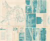
The map covers Sanibel and Captiva Islands, along with nearby keys. Roads, waterways, public institutions, picnic areas, parking lots, public telephones, and public restrooms are labeled throughout. The Sanibel Causeway and Sanibel Lighthouse are marked at right, while the J.N. 'Ding' Darling National Wildlife Refuge is shaded on the north side of Sanibel. A grid surrounds the map corresponding to a street index at top. The verso contains promotional text and photographs, a table of water temperatures by month, some rules and guidelines for visiting the islands responsibly, and a basic highway map of the wider Fort Myers-Cape Coral area.Historical Context
This map was produced as the islands were facing intense pressure to develop as a resort destination after the 1963 opening of the Sanibel Causeway. Locals treasured the sanctuary-like environment and voted in 1974 to incorporate as the City of Sanibel to fend off overdevelopment. The 1976 'Sanibel Plan' was a visionary piece of legislation that prioritized environmental carrying capacity over profit, strictly limiting building heights and residential density to prevent infrastructure from overwhelming the islands' ecology. At the same time, the J.N. 'Ding' Darling National Wildlife Refuge, established in 1945, was greatly expanded in 1976, adding more than 2,600 acres, increasing it by roughly 40 percent. The Refuge played a key role in conservation efforts, covering nearly half of Sanibel. Its sprawling mangrove forests and seagrass beds serve as a natural storm buffer. Although Sanibel's population continued to grow rapidly into the 1980s, it did so within the confines of the 1976 plan, ensuring that conservation was prioritized over development.Publication History and Census
This map was published by the Sanibel-Captiva Chamber of Commerce around the year 1978, a date determined by the inclusion of the 1976 extension of the original J.N. 'Ding' Darling National Wildlife Refuge. Several OCLC listings include maps with this title published by the Chamber of Commerce, dated between 1972 and 1990. Indeed, multiple editions of the map do appear to exist, some dated and some not (see, for comparison, the dated 1972 map held by the Touchton Map Library, Accession Number 2018.115.042). Therefore, a precise census is impossible to establish, but institutions holding editions of this map with supposed dates in the late 1970s include the Library of Congress, University of Michigan, University of Miami, and the University of Illinois at Urbana-Champaign.Condition
Very good. Some wear and slight loss on some of the original fold lines. Toning on verso.
References
OCLC 5677350, 1401993675.