
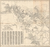
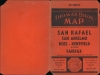
1946 Thomas Brothers Map of San Rafael and Environs, Marin County, California

This item has been sold.
Thomas Bros. Map of San Rafael, San Anselmo, Ross, Kentfield, Fairfax, Larkspur and Corte Madera.
Scenic Wonderland on San Francisco Bay.
- Digital Map Information
- Suitable for large format printing
- File Size: 31.36 MB
- File Type: ZIP / TIFF
- ICC color profile embedded
- Delivered instantly via download link
Scenic Wonderland on San Francisco Bay.
This is a c. 1946 Thomas Brothers folding map of San Rafael, San Anselmo, and nearby communities in Marin County, in the San Francisco Bay Area of California.A Closer Look
Coverage includes the towns of San Rafael, San Anselmo, Ross, Kentfield, Fairfax, Larkspur, and Corte Madera. Portions of the northern part of the San Francisco Bay appear at right, while Mt. Tamalpais, not directly mentioned, stands roughly where the index appears at bottom-left. The mountain and much of the surrounding land, including the undeveloped land in the western and northern part of the area covered by this map, is protected, either as state or county parks and preserves (to the south of Mt. Tamalpais are federally protected lands: Muir Woods National Monument and the Golden Gate National Recreational Area). Though some hills are mentioned and one even illustrated (Red Hill in San Anselmo), in the interest of utility, the steep topography in the area is not depicted, though it can be surmised by the winding roads and tightly packed development. Streets are traced and named throughout and listed in the aforementioned index, corresponding to the grid surrounding the map. Several local landmarks can be easily identified, including San Francisco Theological Seminary (founded 1871), Dominican College (now Dominican University, founded 1890), and the Northwestern Pacific Railroad (discussed below). Not included is San Quentin State Prison, just beyond the scope of the map near the Richmond - San Rafael Ferry.The Northwestern Pacific Railroad
The Northwestern Pacific Railroad (N.W.P.R.R.) was formed in 1907 by an agreement between the Southern Pacific and Atchison, Topeka, and Santa Fe Railway, both of which had an interest in bringing timber from northern California as far as Humboldt County to the San Francisco Bay. Both railroads had an existing network in coastal northern California (including several predecessor lines in Marin County), but both also recognized they would not benefit from a price war between competing lines running the full length from the Bay to Humboldt County. But in 1929, the Atchison, Topeka, and Santa Fe sold its half share to the Southern Pacific, making the N.W.P.R.R. a fully-owned subsidiary. The railroad was the primary means by which the towns of Marin County were linked and, in turn, connected to San Francisco and the rest of the Bay Area via ferries (including a connection in Mill Valley with the Mount Tamalpais and Muir Woods Railway). However, the expanding use of automobiles, the development of highways (U.S.-101 seen right here), and the construction of the Golden Gate Bridge (1937) greatly reduced demand for passenger service, though it continued to be operated until 1958 (freight operations continued until 1998). Today, a portion of the N.W.P.R.R. network in Marin County operates between Santa Rosa, through San Rafael, to Larkspur as the Sonoma - Marin Area Rail Transit (SMART).Publication History and Census
This map was prepared by Thomas Brothers in c. 1946. There are multiple editions of maps published by them with similar titles that are dated or presumably dated in catalog listings produced between 1936 and 1961. The present edition (distinguishable by the number '643' at bottom-left) is dated in the OCLC as c. 1946 and noted among the holdings of the University of California, Los Angeles and the University of Wisconsin - Milwaukee.Cartographer
Thomas Brothers (1915 – 1999) was a prominent California-based English-American publisher specializing in maps and guidebooks. Founded in Oakland in 1915 by George Copeland Thomas, Guilbert Thomas, and Leonard Thomas, the company began modestly, selling maps of movie stars' homes from a Hollywood street corner, before developing into a major cartographic and guidebook publisher. Following George Thomas's death in 1955, his widow retained attorney Warren Wilson to organize the company's affairs. When none of the Thomas heirs expressed interest in continuing the business, Wilson and accountant Tom Tripodic purchased it, preserving the Thomas Brothers tradition while pursuing a new direction and eventually relocating the company's headquarters from San Francisco to Irvine, California. The firm prospered under Tripodic, growing to more than 200 employees and dominating the West Coast map market. Rand McNally acquired Thomas Brothers in 1999, laid off many of its experienced cartographers and employees in 2003, and closed the company's remaining California operations in 2009. Further Details...
Condition
Very good. Light wear along original fold lines. Verso repairs to fold separations and at fold intersections. Reinforced where previously attached to binder. Slight offsetting, especially around margins. Accompanied by original binder.
References
OCLC 64589672.