
1970 Manuscript Wall Planning Map of the Port of Seattle, Washington

This item has been sold.
Preliminary Long Range Harbor Study Ownership.
Pioneering Containerization.
Choose a Collection:
This Item
Enquire
Pioneering Containerization.
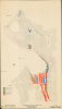
This is a unique c. 1970 manuscript wall map of Seattle prepared by the Port of Seattle. It is notable for indicating land ownership on Harbor Island and along the Duwamish River, and for suggesting planned (but never materialized) development along the city's waterfront.A Closer Look
Seattle is displayed with roads traced and, in some cases, labeled. Railroad lines, waterways, and the coastal contours are traced. Most notably, land ownership of port facilities throughout the city is shown, with colors indicating government, private, and leased ownership. A planned but unmaterialized waterfront landfill north of downtown is ghosted in - this was a long-sought goal of urban planners.Historical Context
The map's purpose is future planning for the Port of Seattle, which had become a perennial money loser by the 1950s, falling from the busy days of World War II (1939 - 1945). The Port saw modernization and containerization as a way to revive its fortunes. Containerization is a critical component of today's world economy, whereby standardized intermodal containers are used internationally, allowing for goods to be transported via a uniform standard. The 1960 Mechanization and Modernization Agreement between the Port and the longshoremen's unions, which stood to lose jobs with containerization, cleared the way for the Port's modernization. Plans for the future of the Port, centered on a new contained port in the Duwamish Waterway, were unveiled at Seattle's Century 21 Exposition (1962 World's Fair). Another component of the plan was the development of 'marginal' coastal lands, which could be leased or sold to private interests. These plans were largely successful, and by the end of the 1960s, Seattle was the second-busiest port on the West Coast.A secondary feature of the map, but no less interesting, is the planned landfill and development in Magnolia, along the coastline north of downtown. Such a project had been considered by urban planners for decades, beginning with Seattle's burst of landfill and infrastructure projects at the turn of the 20th century, and the resulting plats of these tidelands (1895 Seattle Tidelands Survey) were standard on maps of Seattle throughout the 20th century. But in 1912, voters rejected the planned development of Magnolia's tidelands. By the 1960s, as it became clear that Fort Lawton would be retired from military use, a variety of plans were floated for the adjacent area, including luxury housing, shopping, and even a golf course. But following public pressure and advocacy, Seattle passed a 1970 resolution committing to developing the base as a public park. After fending off additional development plans, Discovery Park opened in 1974 and remains one of the great urban wildernesses. Meanwhile, the adjacent tidelands continue to be considered for development, especially housing.
Publication History and Census
This map was prepared by the Planning Department of the Port of Seattle. It is undated (the '1965' at bottom-right appears to refer to something else), but we estimate c. 1970. The presence of the Alaskan Way Viaduct near Harbor Island suggests a date after 1959, as would the presence of Interstate-5 at right (not labeled), while the retention of Fort Lawton instead of Discovery Park means it can date no later than 1972. More specifically, the leasing of two piers in Smith Cove to the Port of Seattle indicates a date of March 1970 or later, although no reference is made to the Pier 86 Grain Terminal, opened in November 1970, suggesting a date in the middle of 1970. Though seemingly part of a larger study (Preliminary Long Range Harbor Study), we have been unable to locate any more information on this study, nor any other examples of the map in institutional collections or on the market.Condition
Very good.