
1958 Hoffman / Walker Pictorial Historical Wall Map of Texas

This item has been sold.
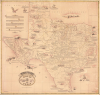
Hoffman and Walker's Pictorial Historical Map of Texas.
Texas history condensed into a massive map.
Texas history condensed into a massive map.
This is a scarce large-format 1958 pictorial wall map of Texas, prepared by William Hoffman and Bill Walker. It is replete with fascinating annotations detailing Texas history, facts, and folklore, with a focus on the mid-19th century, from the Texas Revolution through the Indian Wars of the 1870s and early 1880s.A Closer Look
The production of this map was clearly a labor of love, as William Hoffman spent years preparing it while working as a draughtsman in the oil industry. His familiarity with maps led him to consult historical maps of Texas, which he supplemented with additional historical research, resulting in a map originally intended for his personal use but which he published at his friend Bill Walker's encouragement, who assisted with the historical research. A measure of the work involved in producing the map is given by the explanatory text at top-left, which lists source maps, including even the county surveys issued by the Texas General Land Office, and notes that Hoffman and Walker visited many of the sites mentioned in the course of preparing their map.As mentioned in the explanatory text, the map reflects the State of Texas on the eve of the U.S. Civil War, in the late 1850s. The borders of especially large ranches and land grants are outlined, and the land shaded pink. Waterways are traced throughout, while the distinctive Cross Timbers ecoregion is shaded, with hachure to denote elevation. The routes of historic trails and expeditions are traced in yellow and labeled, while the locations of cities, missions, and forts are recorded. Illustrations throughout depict early explorers, pioneers, and specific events in Texas' history, especially from the long history of wars against Native Americans, particularly the Comanche, which were at times especially gruesome.
Some of the stories are more amusing, such as the failed attempt by the U.S. Army to replace pack mules with camels; the names of the officers involved list several future Civil War generals, including Robert E. Lee. The camel experiment was taken over by Confederate forces in 1861, but they met with no more success than their predecessors. Another curious tale is that of Josiah Wilbarger, recounted to the east of Austin, who in 1833 was ambushed by Comanche while surveying land for the Austin colony, suffered multiple wounds and a scalping, but managed to survive until he was rescued.
The Clash of Texas and Comanchería
Although the map traces a long arc of Texas' history from the landing of Spanish explorer Álvar Núñez Cabeza de Vaca in 1528 to the hurricane of 1900, both events involving Galveston incidentally, a considerable share of the map's historical vignettes deal with battles between Anglo/Texian settlers and the Comanche. By the time the Republic of Texas was established in 1836, the Comanche had evolved into a dominant nomadic power, utilizing expert horsemanship to control a vast territory stretching from the Arkansas River to the Rio Grande. Unlike earlier interactions with Spanish and Mexican authorities, which often alternated between trade and low-intensity raids, the arrival of Anglo settlers led to a fundamental clash over land and resources. The Comanche viewed the settlers as encroachers on their hunting grounds, while the Texians, particularly under leaders like Mirabeau B. Lamar (second President of the Republic of Texas), adopted a policy of total expulsion or extermination, setting the stage for decades of brutal frontier warfare.The conflict reached a violent peak in the 1840s, sparked by the infamous Council House Fight in San Antonio. In March 1840, a peace delegation of Comanche chiefs was killed during a negotiation gone wrong, leading Chief Buffalo Hump to organize the Great Raid of 1840, the largest Native American raid ever conducted against White settlements in the United States. As the map makes clear, raids and massacres occurred regularly in the following years, as ranchers sought to graze or drive cattle on lands historically used by the Indians. The final chapter of this struggle occurred in the 1870s with the Red River War, a massive military campaign launched by the United States Army to end nomadic resistance on the Southern Plains. Following a failed effort to settle the Comanche and other Plains Indian groups, such as the Kiowa, in the Indian Territory (now Oklahoma), in 1867, the U.S. Army began to systematically kill buffalo to deprive Indians of their food source while also launching expeditions into Indian lands, resulting in few large battles but skirmishes and forced migrations. Commercial hunters took an even greater toll, with the buffalo becoming nearly extinct by the late 1870s. Although sporadic fighting with the Comanche and other groups, including some Apache, continued, there were no large-scale engagements after 1882.
Publication History and Census
This map was prepared and published by William H. Hoffman and Bill Walker. It has been dated to anywhere between 1958 and 1970, but the Library of Congress' Catalog of Copyright Entries for 1958 shows that the copyright for the map was filed in July 1958. Two printings of the map exist, which are identical except for the address given in the imprint in the bottom corners; here being an address in Houston, while other examples bear an imprint with an address in Midland. A reference index to the map was also published as a separate booklet in 1962 (OCLC 1020172489) and A Compilation of the Text of the Hoffman-Walker Map of Texas (OCLC 603121591).Later, smaller-format editions of the map were also issued with the same title (at least one by the firm Ante-Bellum Maps of Texas based on Midland), leading to confused cataloging. Therefore, it is difficult to establish a precise census for the map. Although cataloged by title at several dozen institutions in the OCLC, nearly all of these appear to be later and smaller printings of the map. The present large-format printing can only verifiably be located at Texas A and M University, the University of Arizona, Midwestern State University, the University of Texas at Arlington, the Hardin-Simmons University Library (digitized through the Portal to Texas History), Harvard University, the Bibliothèque nationale de France, and the David Rumsey Historical Map Collection.
Cartographer
William Herman Hoffman (June 12, 1899 - July 24, 1973) was a draftsman, civil engineer, and cartographer based in Texas who worked in the oil industry before launching his own firm producing historical maps of his home state. Born in Sherman, Texas, Hoffman relocated to Midland, Texas, where he worked for the Humble Oil Company, before moving to Houston (seemingly as a result of military service in the U.S. Army as a Warrant Officer), then Kingsland and Austin. Following his military service, Hoffman remained in Houston and later married Bessie Proctor and had two children. After retiring from the oil industry, Hoffman and friend Bill Walker produced an impressive historical wall map of Texas in 1958 based on years of notes by Hoffman and additional historical research undertaken by the duo. The map was reissued in following years in several sizes under the imprint of 'Hoffman and Walker' and later 'Ante-Bellum Maps of Texas.' Further Details...
Condition
Very good. Some surface scuffing in right hand quadrants. Minor pin holes at margins. Minor repair extending 1 inch into map. Margin and border discoloration, upper left.
References
Rumsey 10831.000. OCLC 5495730.