
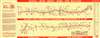
1950 U.S. 54 Association Strip Map of U.S. Highway 54

Go All the Way on U.S. 54.
Travel 'Mid-America's Diagonal Boulevard'!
$175.00
Choose a Collection:
- Digital Map Information
- Suitable for large format printing
- Full resolution TIFF file
- ICC color profile embedded
- Delivered instantly via download link
This Item
Enquire
Travel 'Mid-America's Diagonal Boulevard'!
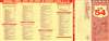
Highlighting 'Mid-America's Diagonal Boulevard', this is a c. 1950 U.S. 54 Association strip map of U.S. Highway 54. Connecting Chicago with El Paso and Juarez, Mexico, the map identifies cities and towns all along the highway. A few sites are marked along the highway as well, such as Ute Dam in New Mexico and Lake of the Ozarks in Missouri. Radio stations are identified along the highway as well, providing news and entertainment. Connecting highways branch off from U.S. 54, allowing for some additional context. An 'index' of cities and towns along the highway in order from Chicago to El Paso occupies the verso.Highway Associations
The movement promoting the construction of 'good quality' roads did not begin with the invention of the automobile, but rather with the bicycle. At the time, most interurban roads were unpaved and impractical for cycling. The 'Good Roads Movement' was inaugurated in May 1880 to advocate for bicycle enthusiasts, riding clubs, and manufacturers. By 1910, the American Automobile Association (AAA) jumped onboard, along with over one hundred other local and national organizations. 'Road booster' organizations emerged to promote specific, often branded, highways. By the 1920s, about 250 'named' highways, each with their own boosters, crossed the United States. 'Road boosters' still exist, but most disbanded in the 1950s and 60s with the emergence federally funded Interstate Highway System.Publication History and Census
This map was created and published by the U.S. 54 Association. We note a single cataloged example which is part of the collection at Southern Illinois University.Condition
Very good. Light wear along original fold lines. City 'itinerary' on verso.
References
OCLC 785894432.