
Atkinson, G.W.E.

G.W.E. Atkinson (fl. c. 1859 – 1898) was a British military surveyor and expert on Tibet, the Himalayas, and Central Asia who worked with the Survey of India in the late 19th century. He first joined the Survey in 1859 and worked his way up the ranks, eventually becoming a Surveyor of the First Grade in the Drawing Office in Simla and later Assistant Superintendent of the same office in 1894, retiring in October 1898 and eventually receiving the rank of Esquire in 1901 in recognition of his services. He was considered an expert on 'transfrontier geographical mapping' and published several accounts of Indian and Tibetan pundits who had explored Tibet and neighboring regions for the British (most notably Narrative Account of Rinzin Nimgyl's Explorations in Sikkim , Bhutan and Tibet , in 1885-86). He also produced important maps on Kashmir (Map of Kashmir, 1873), Central Asia (Turkestan: and the countries between the British and the Russian dominions in Asia, first edition 1875), and a series of gazetteer maps.
The Great Game: Competition and Cooperation.
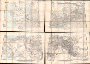
Turkestan and the countries between the British and the Russian Dominions in Asia.
$1,800.00
Acquire
- Digital Map Information
- Suitable for large format printing
- Full resolution TIFF file
- ICC color profile embedded
- Delivered instantly via download link
This is a fascinating 1879 map of Central Asia, divided into four large folding sheets, produced by G.W.E. Atkinson, a British Survey of India expert on Tibet, the Himalayas, and Central Asia. It was produced at the height of the 'Great Game' and intended for use by the government and military of British India. This map provides unique insight into the collaborative process of Russian and British surveyors operating in Central Asia despite ongoing political conflict. (more details)
Pundits on the 'roof of the world'.
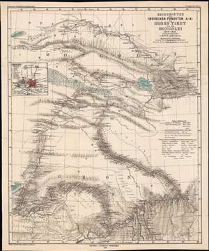
Reiserouten des Indischen Punditen A - K - in Gross Tibet und der Mongolei 1879 - 1882.
$400.00
Acquire
- Digital Map Information
- Suitable for large format printing
- File Size: 22.03 MB
- File Type: ZIP / TIFF
- ICC color profile embedded
- Delivered instantly via download link
This is an 1885 map of expeditions in western China compiled by G.W.E. Atkinson. The map depicts much of today's Qinghai Province and Tibetan Autonomous Region. The map is based not only upon European expeditions, but also those of the Pundits, or Pandits - Indian and / or Tibetan explorers working secretly for the British. (more details)
'Confidential' detailed map of Nepal caught between empires.
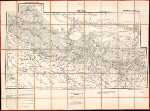
Nepal, with part of Tibet: N[orthern] T[rans] F[rontier] Sheets No. 15. 16. 22. 23.
$5,500.00
Acquire
- Digital Map Information
- Suitable for large format printing
- File Size: 261.1 MB
- Full resolution TIFF file
- ICC color profile embedded
- Delivered instantly via download link
This is a rare 1892 large-format dissected folding map of Nepal and nearby territories produced by the Survey of India. It is the first edition of the most complete and accurate 19th-century survey of Nepal, far exceeding earlier maps in detail and comprehensiveness. Produced during a period of inter-imperial competition in the Himalayas, this map is a product of equal parts espionage and exploration. (more details)