
Bach, John
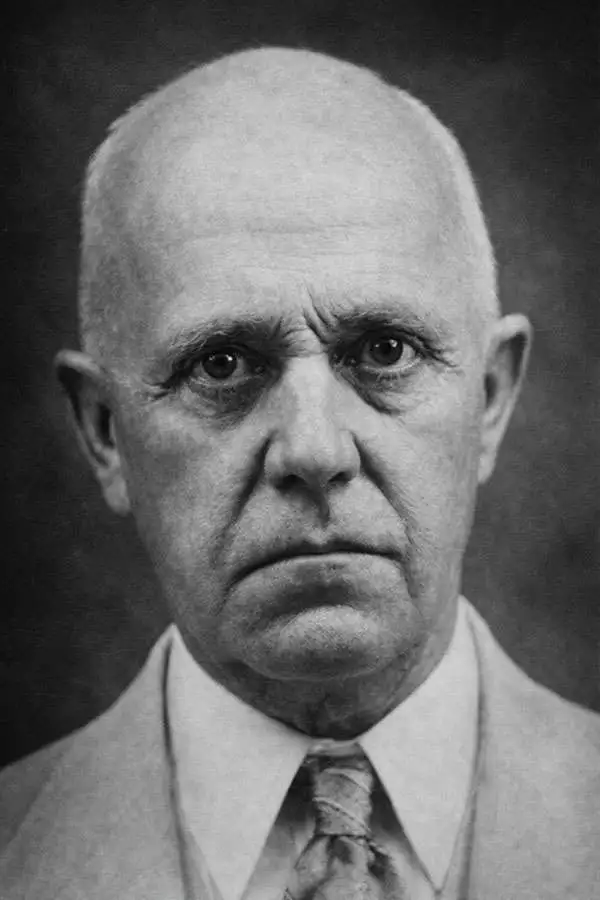
John Bach (February 10, 1872 - c. 1942) was a Norwegian-American cartographer. Born in Kristiansand, Norway, Bach studied civil engineering at the Trondheim Technical School, graduating in 1872. After graduating, he worked for a short time in local architectural drafting before emigrating to the United States, arriving in New York in March 1893 and becoming a naturalized citizen on January 10, 1902. In New York, he originally worked as an ironworker in the elevator industry, then, just getting off the ground. In 1896, Bach accepted a position with the Argentine Government conducting boundary surveys in the Andes Cordillera. He returned to New York in 1902 to take his oaths of citizenship, then on April 20, 1902, was appointed to the U.S. Coast and Geodetic Survey's Manila Field Station, in the Philippine Islands. There, he became part of the years-long effort to create a comprehensive new survey of the archipelago. Throughout his many years working for the Coast and Geodetic Survey, Bach produced numerous maps of the Philippines for the Survey. He also issued and copyrighted numerous maps privately, from at least 1906 through 1941. Some of his maps are copyrighted by his Philippine-born daughter, Frances L. Bach. By 1917, Bach was the chief of the drafting division in Manila. He worked briefly in the Washington D.C. office of the USCGS in 1927, but returned to Manila in 1928, becoming head of the USCGS Drafting Division there. He officially retired in 1935, the legally mandated retirement age, but in fact continued on at the Survey until at least 1941. Bach married an American, with whom he had two daughters. He likely died in Manila during or shortly after World War II (1939 - 1945). For much of this information, we credit Peter Geldart's excellent article, 'John Bach: Cartographer, collector and historian of maps of the Philippines,' published in the May 2023 #15 edition of the Murillo Bulletin.
Scarce map of the Philippines published in Manila.
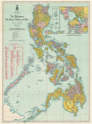
Map to accompany 'The Philippines, The Land of Palm and Pine'.
$750.00
Acquire
- Digital Map Information
- Suitable for large format printing
- File Size: 36.26 MB
- File Type: ZIP / TIFF
- ICC color profile embedded
- Delivered instantly via download link
This is a 1911 John Bach map of the Philippines published in Manila. Provinces are illustrated, labeled, and shaded. Operating railroads on Luzon, Cebu, and Panay appear as thick black with stops noted. Red 'stars' made of bolts of electricity mark wireless telegraph stations: six appear on Luzon and another three operate on Mindanao. Two insets are situated in the upper right. One details the vicinity of Manila and the other the Babuyan Islands, Balintang Channel, and Batan Islands north of Luzon. A table in red along the left border provides overseas port connections with Manila and the shortest distance in nautical miles along with interisland connections between Manila, Cebu, Iloilo, and Zamboanga. (more details)