
1929 Bach Map of the Philippines

This item has been sold.
Philippine Islands.
Philippines at the beginning of the Great Depression.
- Digital Map Information
- Suitable for large format printing
- File Size: 105.61 MB
- File Type: ZIP / TIFF
- ICC color profile embedded
- Delivered instantly via download link
Philippines at the beginning of the Great Depression.
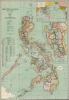
This is a striking Manila-imprint 1929 John Bach map of the Philippines. The map provides a detailed overview of the archipelago as a nexus connecting the Far East with Southeast Asia and the Americas. It was, moreover, issued on the cusp of the Great Depression, which destabilized global economies while setting the stage for Philippine Independence.A Closer Look
Islands are identified, and provinces are delineated in Luzon and Mindanao. Cities, towns, and villages are illustrated along with roads and railroads on all major islands. Natural resources are marked, including gold, iron, chromite, copper, and coal. Lines mark sea lanes between the islands and international routes to Singapore, Saigon, Hong Kong, Japan, and Guam, along with many others. An inset of central Luzon occupies nearly half the right border and details the transportation network between San Fernando and Lucena. In the upper right, a second inset highlights trade routes across the Pacific and through the Indian Ocean to Aden. A distance table appears along the left border and notes distances to international ports and interisland routes.Historical Context
In 1929, the Philippines was under American colonial rule, with a population of around 13 million. The late 1920s were a period of relative peace and stability following several years of political unrest and armed conflict. This allowed industry and commerce to grow exponentially. However, tensions between the ruling American government and Filipino nationalists were still high and calls for independence continued to grow. Moreover, in the year this map was issued, the Great Depression (1929 - 1939) began in the United States, driving the colony's major trading partner and the global economy in general into dire straits. At the same time, the Philippine nationalist movement grew stronger, with leaders such as Manuel Quezon advocating for self-rule and greater autonomy from American colonial rule. The economic crisis exposed the limitations of the colonial government's ability to address the country's economic challenges, further fueling demands for independence. The Commonwealth of the Philippines was established in 1935, which granted the country more autonomy and a pathway towards independence.Publication History and Census
This map was compiled and published by John Bach in 1929 and lithographed by Carmelo and Bachmann in Manila. It is the sixth edition of John Bach's map of the Philippines. This map is well represented in institutional collections.Cartographer
John Bach (February 10, 1872 - c. 1942) was a Norwegian-American cartographer. Born in Kristiansand, Norway, Bach studied civil engineering at the Trondheim Technical School, graduating in 1872. After graduating, he worked for a short time in local architectural drafting before emigrating to the United States, arriving in New York in March 1893 and becoming a naturalized citizen on January 10, 1902. In New York, he originally worked as an ironworker in the elevator industry, then, just getting off the ground. In 1896, Bach accepted a position with the Argentine Government conducting boundary surveys in the Andes Cordillera. He returned to New York in 1902 to take his oaths of citizenship, then on April 20, 1902, was appointed to the U.S. Coast and Geodetic Survey's Manila Field Station, in the Philippine Islands. There, he became part of the years-long effort to create a comprehensive new survey of the archipelago. Throughout his many years working for the Coast and Geodetic Survey, Bach produced numerous maps of the Philippines for the Survey. He also issued and copyrighted numerous maps privately, from at least 1906 through 1941. Some of his maps are copyrighted by his Philippine-born daughter, Frances L. Bach. By 1917, Bach was the chief of the drafting division in Manila. He worked briefly in the Washington D.C. office of the USCGS in 1927, but returned to Manila in 1928, becoming head of the USCGS Drafting Division there. He officially retired in 1935, the legally mandated retirement age, but in fact continued on at the Survey until at least 1941. Bach married an American, with whom he had two daughters. He likely died in Manila during or shortly after World War II (1939 - 1945). For much of this information, we credit Peter Geldart's excellent article, 'John Bach: Cartographer, collector and historian of maps of the Philippines,' published in the May 2023 #15 edition of the Murillo Bulletin. Further Details...
Condition
Very good. Light wear along original fold lines. Verso reinforcement where previously adhered to binder.
References
OCLC 64008097.