
Bechler, Gustavus R.

Gustavus R. Bechler (fl. c. 1856 - 1878) was a surveyor and cartographer best known for his work with the U.S. Geological and Geographical Survey of the Territories (USGGST), led by Ferdinand Vandeveer Hayden. He appears to have gotten his start producing maps of counties in Pennsylvania, New York, and Michigan. During the U.S. Civil War, he drew several impressive, large-scale maps of highlighting battles and campaigns. Virtually nothing is known of Bechler's biographical details, despite being one of the more prolific members of USGGST, acting as chief topographer on Hayden's expedition to Yellowstone. The scant notes referring to him by other members of the survey suggest that he was skilled but difficult to work with. The Bechler River in Yellowstone National Park is named for him.
Surveying the High Desert.
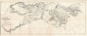
Map of the Country Between Yampa and White Rivers (For General Reference) to accompany the Report of Gust. R. Bechler.
$400.00
Acquire
- Digital Map Information
- Suitable for large format printing
- File Size: 27.41 MB
- File Type: ZIP / TIFF
- ICC color profile embedded
- Delivered instantly via download link
A large format 1876 map of a portion of northwestern Colorado and northeastern Utah, prepared to accompany a report by Gustavus Bechler that appeared in the Tenth Annual Report of the United States Geological and Geographical Survey of the Territories.... The northern portion of this map overlaps with today's Dinosaur National Monument. (more details)