
Bregante y Orbay, Francisco

Francisco Bregante y Orbay (fl. 1840 - 1867) was a Spanish engraver and draftsman active with the Dirección Hidrografía in the middle part of the 19th century. Bregante y Orbay specialized in lettering and text. A relative, Salvador Bregante y Orbay, also worked for the Dirección Hidrografía in a related capacity.
Charting an 1867 Spanish voyage around the Caribbean.
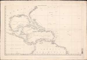
[West Indies, Florida, Gulf of Mexico]
$1,750.00
Acquire
- Digital Map Information
- Suitable for large format printing
- Full resolution TIFF file
- ICC color profile embedded
- Delivered instantly via download link
This is a scarce c. 1838 Direccion Hidrografia nautical chart or maritime map of the West Indies, Florida, the Gulf of Mexico, and the Caribbean. Centered on Hispaniola, the map covers from Cape Hatteras, North Carolina, to the Equator, and from the Pacific coast of Central America to the mouth of the Amazon River. Manuscript notates throughout follow the 1867 voyage of a Spanish ship. (more details)
Turbulent Waters.
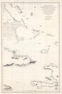
Carta Esferica que comprende parte de las Islas de S.to Domingo, Jamaica, Cuba, Lucayas Y Gran Banco de Bahama.
$1,200.00
Acquire
- Digital Map Information
- Suitable for large format printing
- File Size: 29.79 MB
- File Type: ZIP / TIFF
- ICC color profile embedded
- Delivered instantly via download link
A highly detailed 1856 nautical chart produced by Spain's Dirección de Hidrografía, taking in portions of the Bahamas, Cuba, Haiti, and Jamaica, and their surrounding waters. It was made as Spain tried to develop naval power to maintain a tenuous hold on its remaining American colonies, Cuba and Santo Domingo. (more details)
Charting Florida.
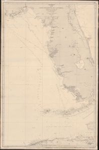
Seno Mejicano. Carta de la Costa Occidental de la Florida y Parte de La Isla de Cuba segun los trabajos mas modernos nacionales y estrangeros.
$950.00
Acquire
- Digital Map Information
- Suitable for large format printing
- Full resolution TIFF file
- ICC color profile embedded
- Delivered instantly via download link
A scarce 1866 working Spanish Dirección de Hidrografía nautical map of peninsular Florida and northern Cuba. This chart was used by the Santiago, one of the first steamships to ply the Havana-Cadiz route. (more details)