
Charle, Jean Baptiste-Louis

Jean Baptiste-Louis Charle (fl. c. 1800 - 1850) was a prominent French Geographer active in the early to mid 19th century. His is known to have worked with Victor Levassuer, Lapie, and others. Despite a large corpus of work, little is known of Charle's life.
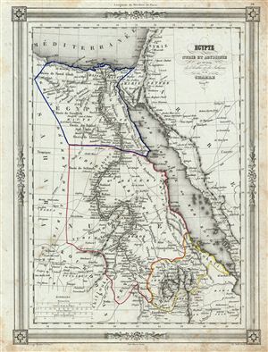
Egypte Nubie et Abyssinie avec une partie de l'Arabie et du Sahara.
$150.00
Acquire
- Digital Map Information
- Suitable for large format printing
- DPI: 300
- File Size: 15.42 MB
- File Type: ZIP / TIFF
- ICC color profile embedded
- Delivered instantly via download link
An uncommon and extremely attractive 1852 map of egypt, Nubia and Abyssinia. The map covers the lower Nile Valley including egypt, Nubia and Abyssinia (ethiopia), as well as the adjacent Arabian Gulf or Red Sea, parts of Sudan, Arabia and the Sahara. Throughout, ... (more details)