
Duvallon, Pierre-Louis Berquin

Pierre-Louis Berquin Duvallon (1769 - 1814) was a French sugar planter and procureur du roi in French Santo Domingo before the Haitian Revolution (1791 - 1804). Berquin-Duvallon was born in Santo Domingo. In 1793 in the Revolution he fled to Baltimore - specifically as Maryland allowed him to bring and keep his slaves. (Louisiana, of note, did not allow the import of Haitian slaves after the 1791, for fear they would spread revolutionary sentiment.). In 1800, he travled to New Orleans, where he found trouble with the law as he brought his illegal Haitian slaves. Nonethless, he traveled through Louisiana, and purchased a plantation on the Tchoupitoulas Coast. It was there that he wrote the travel account for which he is best remembered, Vue de la Colonie Espagnole du Mississipi ou des provinces de Louisiane et Floride Occidentale en l’an 1802.
Louisiana on the cusp of the Louisiana Purchase.
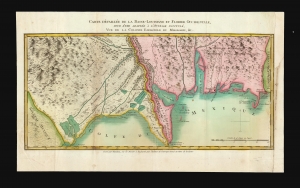
Carte Détaillée de la Basse-Louisiane et Floride Occidentale, pour étre adaptée à l'Ouvrage intitulé, Vue da la Colonie Espagnol due Mississipi, et c.
$2,000.00
Acquire
- Digital Map Information
- Suitable for large format printing
- DPI: 600
- File Size: 21.3 MB
- File Type: ZIP / TIFF
- ICC color profile embedded
- Delivered instantly via download link
This is Alexandre's Blondeau's exceptional 1803 map of Spanish-administered Louisiana and West Florida, issued for Pierre-Louis Berquin Duvallon's travel narrative, Vue de la Colonie Espagnole due Mississipi. It is one of the best maps to capture the Gulf littoral during the Post-American Revolutionary War Spanish period on the cusp of the Louisiana Purchase. (more details)
Louisiana on the cusp of the Louisiana Purchase.
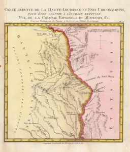
Carte Reduite de la Haute-Louisiane et Pays Circonvoisins, pour etre adaptee a l'ouvrage intitule Vue de la Colonie Espagnole du Mississipi, et c.
$1,000.00
Acquire
- Digital Map Information
- Suitable for large format printing
- DPI: 600
- File Size: 3.93 MB
- File Type: ZIP / TIFF
- ICC color profile embedded
- Delivered instantly via download link
This is Alexandre's Blondeau's exceptional 1803 map of Spanish-administered upper Louisiana, issued for Pierre-Louis Berquin Duvallon's travel narrative, Vue de la Colonie Espagnole due Mississipi. It is one of the best maps to capture the Upper Mississippi Valley on the cusp of the Louisiana Purchase. The map moreover underscores the significance of the Mississippi River as a trade artery between the Great Lakes, and hence the Atlantic, and the Gulf of Mexico. (more details)
...gossipy first-hand picture of life in New Orleans at the turn of the century. - Streeter
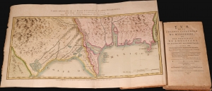
Vue de la colonie Espagnole du Mississipi, ou des provinces de Louisiane et Floride Occidentale, en l'année 1802 de Louisiane et Floride occidentale, en l'année 1802, par un observateur résidant sur les lieux.
$2,800.00
Acquire
This is Pierre-Louis Berquin Duvallon's 1803 travel narrative describing Spanish-administered Louisiana and West Florida on the cusp of the Louisiana Purchase. The work offers an entertaining and often critical account of political, economic, and social life in New Orleans between 1800 and 1802. It also includes two important maps, being among the few specific maps of Upper and Lower Louisiana and West Florida during the Spanish period. (more details)