
Gall and Inglis

Gall and Inglis' (1810 - 1960) were Edinburgh based publishers. The firm was founded c. 1810 by James Gall. Gall went through a series of partnerships with other publishers including Turnbull, Hay, and finally Robert Inglis. Their publishing work consisted of novels, textbooks, guide, and essays as well as maps. They were also ordinance survey publishers.
Beautiful plan of central London.
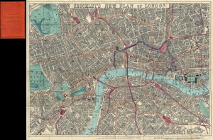
Cruchley's New Plan of London.
$550.00
Acquire
- Digital Map Information
- Suitable for large format printing
- File Size: 21.56 MB
- File Type: ZIP / TIFF
- ICC color profile embedded
- Delivered instantly via download link
A first-edition example of George Frederick Cruchley's 1860 pocket map of London, England. The map captures the city at the height of the city-wide 19th-century urbanization that coincided with the Industrial Revolution. (more details)