
Johnson, David Griffing

David Griffing Johnson (1808 - April 9, 1863), aka 'Griffin', is a mysterious but significant American engraver and mapmaker active in Portland, Maine, New Orleans, and New York City in the decades preceding the American Civil War (1861 - 1865). Our knowledge of him is scant. He was likely born in Connecticut. We believe him one and the same with David G. Johnson, a map engraver, who first appears in Portland, Maine in 1824, where he had an office at No. 4, Market Square in Gilbert’s Block. He was not a native to that city, instead arriving in 1824 with the intent to establish himself as the city's premier engraver. This seems not to have worked out, but he did produce a few maps, portraits, nautical charts, and novelties. He left Portland in 1830, eventually settling in New York, where we can place him in 1831. In New York he promoted himself as a portrait painter and engraver from 1831 to 1835. He appears to have had little success during this period, but did engrave the plates for the 1833 A Treatise on Topographical Anatomy. Shortly thereafter, he relocated to New Orleans. He was in New Orleans from at least 1838 to 1843, where he set up an engraving and daguerreotype studio. While there, he engraved E. H. Springbett and L. I. Pilié's 1839 Topographical Map of the City and Environs of New Orleans, of which we can frustratingly find no surviving examples but several references. We note correspondence in 1840 between Johnson and Samuel F. B. Morse (inventor of the telegraph and daguerreotype pioneer) asking for advice on daguerreotyping, suggesting that Johnson had difficulty with the process. He returned to New York in 1843, remaining until about 1847, when he issued a map with J. H. Colton. At some point, likely in 1848, D. Griffing Johnson headed west. His 1853 world map and his 1857 North America map both feature a large view of Sutter's Mill with the note, 'Drawn on the spot by D. G. Johnson in 1849'. It is thus believed he was at Sutter’s Mill when gold was discovered or shortly thereafter. There is record of a D. G. Johnson arriving in New York in 1849 on a ship from Jamaica - possibly a transit point having sailed around South America? He was in New York throughout the 1850s to about 1862 or 1863, producing several maps, including a large world wall map in 1853, a North America map in 1853 with 'Thayer, Bridgman and Fanning', and an 1854 North America map with A. J. Johnson, an 1860 world map with Jacob Monk, and an 1862 map of Maine with Henry Francis Walling and Jacob Chace Jr. In 1855 he had an office at 7 Nassau Street, New York. In 1859 he successfully defended himself in New York courts on charges of copyright violation by fellow mapmaker Robert Persall Smith. Regarding D. G. Johnson’s disappearance sometime after 1863, we can only speculate. If our reasoning stands, when was active in Maine in 1824 he would have been at least in his early 20s. Thus by 1863, he would have been in his late 60s, so it is likely he died, but records have been elusive. References: Groce, G.C,. and Wallace, D. H., The New-York Historical Society's Dictionary of Artists in America, 1864 - 1860, p. 353. Smith, M.G., and Tucker, M. L., Photography in New Orleans: The Early Year, 1840 - 1865, p 21-22. Palmquist, P. and Kailbourn, T. R., Pioneer Photographers from Mississippi to the Continental Divide, p. 357. Shettleworth, Earle G., 'Portland, Maine, Engravers of the 1820s', part II, 105 - 109, in Old-Time New England, Volume 61, Number 224 (Spring, 1971). Fales, Marthaq Gandy, 'An Unrecorded Portland Engraver', pages 77-79 in Old-Time New England, Volume 57, Number 207 (Winter, 1967).
Striking large-format map of New York City.
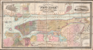
City and County Map of New-York Brooklyn, Williamsburgh, Jersey City and the adjacent Waters etc.
$15,000.00
Acquire
- Digital Map Information
- Suitable for large format printing
- File Size: 101.07 MB
- File Type: ZIP / TIFF
- ICC color profile embedded
- Delivered instantly via download link
This is J. H. Colton's large and impressive case map of New York City, including Brooklyn and Williamsburg. It is one of the largest and best maps of New York City to emerge in the mid-19th century. (more details)
Monk's only world map.
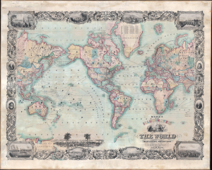
Monk's New Illuminated Steel Plate Map of The World Embracing all the Latest Discoveries and Exploration on Mercator's Projection.
$4,750.00
Acquire
- Digital Map Information
- Suitable for large format printing
- File Size: 156.9 MB
- File Type: ZIP / TIFF
- ICC color profile embedded
- Delivered instantly via download link
This is a magnificent 1860 wall map of the world issued by Jacob Monk and David Griffing Johnson. The map is subtitled 'illuminated' and is a lavish production, rich with detail and graphic content. (more details)
Source of a cartographic feud.
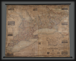
Tackabury's Map of Canada West, drawn from Government and special Local Surveys by H.F. Walling.
$4,500.00
Acquire
This is Henry Francis Walling's very large-format 1862 wall map of Canada West (formerly Upper Canada and subsequently Ontario), published by Robert M. Tackabury and George N. Tackabury. In addition to its size and magnificent level of detail, it is also significant for capturing this region in a period of political and social transformation, driven by railways, immigration, and moves towards greater political union and autonomy. (more details)
First large scale map of the state to be issued after the Greenleaf third edition of 1844. - Rumsey
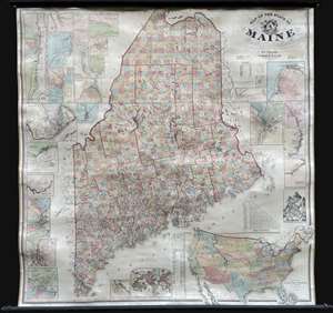
Map of the State of Maine.
$3,000.00
Acquire
- Digital Map Information
- Suitable for large format printing
- Full resolution TIFF file
- ICC color profile embedded
- Delivered instantly via download link
An impressive large-scale 1862 Civil War era wall map of Maine by Henry Francis Walling and Jacob Chace Jr. This the first major map of Maine to follow the 1844 map of Jeremiah Greenleaf. The map represents the culmination of Walling and Chace's decades of work in Maine. For years, they compiled and published Maine city and county maps, giving them access to unprecedented up-to-date cartographic data, all of which is represented here. (more details)