
Keeler, William J.

William J. Keeler (fl. c. 1856 - 1868) was an American civil engineer active during the second half of the 19th century. He is an elusive figure, and little is known of his birth and death dates, places, or early education. He appears in 1856, already working as a civil Engineer in Buffalo with the Erie Canal. In 1862 he received a civilian appointment, and possibly a honorary military rank, to work as an engineer at the Washington Naval Yard. He may also have worked at the Naval Yard in New York (Brooklyn). He was decommissioned in 1864 or 1865, after which he traveled west where he is recorded as an engineer with the Leavenworth, Lawrence and for Gibson Railroad Company. In 1865 he is also mentioned as working with the Union Pacific. In 1866 he was the chief engineer of the Kansas and Nesho Valley Railroad. He appears to have been employed with the department of the Interior Indian Bureau in by 1866 and/or 1867. He released his National Map of The Territory of The United States from the Mississippi River to the Pacific Ocean, one of the most important maps of the American west to appear in the 19th century, 1867. Although based upon government and railroad surveys, the map was a private publication and went through several subsequent editions, reissues, reformatting, and republications. Following the publication of the 2nd edition in 1868, Keeler seems to disappear from all record.
Seminal map of the Trans-Mississippi, in a true 1st Edition 1st State.
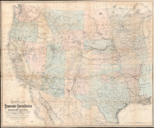
National Map of the Territory of the United States From The Mississippi River To The Pacific Ocean.
$6,500.00
Acquire
- Digital Map Information
- Suitable for large format printing
- Full resolution TIFF file
- ICC color profile embedded
- Delivered instantly via download link
An extraordinary first-edition first-state example of William J. Keeler's seminal 1867 map of the Trans-Mississippi West - considered the finest post-Civil War railroad era map of the West. This is the true first edition, without American Indian reservations, which were added in subsequent editions issued within the same year. (more details)
Seminal map of the Trans-Mississippi showing mineral deposits and the emergence of the American Indian Reservation System.
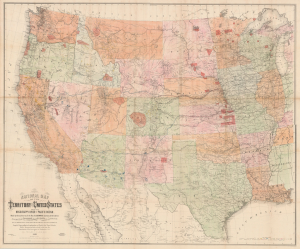
National Map of the Territory of the United States From The Mississippi River To The Pacific Ocean.
$6,500.00
Acquire
- Digital Map Information
- Suitable for large format printing
- File Size: 175.65 MB
- File Type: ZIP / TIFF
- ICC color profile embedded
- Delivered instantly via download link
An extraordinary first-edition third-state example of William J. Keeler's seminal 1867 map of the Trans-Mississippi West - considered the finest post-Civil War railroad era map of the West. The map is noteworthy for its meticulous mapping of mineral deposits and the often overlapping evolution of the American Indian Reservation System. Significantly, this is the finest example of this important map we have seen. Most examples of this map, because it was mounted on linen on a single sheet rather than dissected, typically exhibit significant wear and condition issues. The present example, likely opened only a few times in its long life, exhibits an exceptional state of preservation. (more details)