
Kōgyōkan (廣業舘)

Kōgyōkan (廣業舘; fl. c. 1893 – 1945) was a small-scale publisher in Tokyo that produced a handful of works relating to Japanese overseas communities and colonization efforts in South America, China, and Southeast Asia.
AKA: 廣業舘
A Japanese map of the Philippines, soon after it was captured by Japanese forces in WWII.
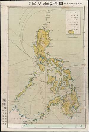
最新ヒリシピン全圖 / [Latest Complete Map of the Philippines].
$250.00
Acquire
- Digital Map Information
- Suitable for large format printing
- File Size: 12.81 MB
- File Type: ZIP / TIFF
- ICC color profile embedded
- Delivered instantly via download link
This is a Colonial Institute of Japan World War II map of the Philippines produced in 1942 (Showa 17), soon after the fall of the islands to the Japanese. It is an artifact of the high tide of Japan's imperial expansion, when its armies seemed invincible. (more details)