
Liozu, Jacques

Jacques Liozu (1910 - 1974) was a French cartographer, painter, and illustrator active during the mid-20th century. Liozu is known for his wonderful pictorial maps of many different parts of the world.
Includes the Philippines, Indonesia, Hawaii, and numerous Pacific island groups.
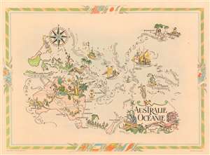
Australie et Océanie.
$275.00
Acquire
- Digital Map Information
- Suitable for large format printing
- File Size: 14.14 MB
- File Type: ZIP / TIFF
- ICC color profile embedded
- Delivered instantly via download link
This is a 1951 Jacques Liozu pictorial map of Australia, the East Indies, and Oceania. Stretching from Borneo and Java to Hawaii and from Hawaii and the Philippines to New Zealand, numerous island groups, are depicted and labeled as well, including the Marianas, Carolinas, Marshalls, Gilberts, Fiji, Solomons, and New Hebrides. Vignettes lend an air of levity to this charming piece. Among these are a kangaroo boxes with an Aussie and wins, while another chases a tourist. Two aborigines are illustrated in Australia, one of which just is drawn getting hit in the head with his own boomerang. Other vignettes include a starving shipwrecked man adrift on a raft encircled by sharks and islanders living in the Hawaiian Islands. The Society Islands are marked by a 'society gentleman' fishing from a rowboat wearing a coat with tails, eyeglasses, and a bowler hat. The whole is surrounded by a colorful border that features the flags of Australia and New Zealand, as well as all the colonial powers still holding possessions in the region. (more details)
Pictorial map of central and eastern Europe.
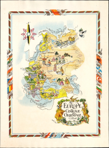
Europe Centrale et Orientale.
$350.00
Acquire
- Digital Map Information
- Suitable for large format printing
- Full resolution TIFF file
- ICC color profile embedded
- Delivered instantly via download link
This is a colorful pictorial map of Eastern Europe dominated by the Soviet Union, drawn by Jacques Liozu in 1951. It is embellished with stereotypical imagery and charming animals. (more details)
Rare Pictorial Map of Paris and Environs.
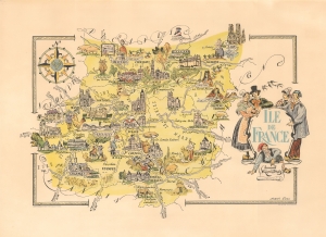
Ile de France.
$300.00
Acquire
- Digital Map Information
- Suitable for large format printing
- File Size: 14.46 MB
- File Type: ZIP / TIFF
- ICC color profile embedded
- Delivered instantly via download link
This colorful pictorial map of Ile-de-France, including Paris, was drawn by Jacques Liozu in 1951. (more details)