
Lowitz, Georg Maurice

Georg Maurice Lowitz (1722 - 1774) was a German cartographer, astronomer and professor of mathematics. His youth is not documented, but his parents were Wolfgang Lowitz and Catherine Lobits. He was director of the observatory at Göttingen for a timne. In 1766 he travelled to Saint Petersburg, Russia, to join the Academy of Sciences. He observed the 1769 transit of Venus from Gureyev (modern Atyrau) north of the Caspian Sea. During the 1773-75 Pugachev Rebellion he was employed by Russia in making surveys to construct a canal between the Volga and the Don rivers when he was captured by Pugachev's Cossacks, and killed.
Detailing a Projected Annular Solar Eclipse.
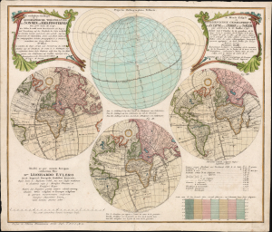
Die verfinsterte Erdkugel d. i. Geographische Vorstellung der Sonnen- od. Erd-Finsternis den 25ten Iulii Ao. 1748/ Le Monde Eclipse ou Representation Geographique de l'Eclipse De La Terre Ou Du Soleil qui arrivera le 25. Iuillet 1748.
$1,650.00
Acquire
- Digital Map Information
- Suitable for large format printing
- File Size: 25.93 MB
- File Type: ZIP / TIFF
- ICC color profile embedded
- Delivered instantly via download link
This is Georg Moritz Lowitz's 1747 celestial chart, projecting the annular solar eclipse of July 25, 1748. Published by the Nuremberg map printing house of Homann Heirs, this bilingual chart detailed the parts of the world from which the event would be visible, using a series of stereographic projections of the world to illustrate the track of the eclipse. An additional hemisphere illustrates the path of the center of the eclipse around the globe. (more details)
Revealing a separate Asia and America.
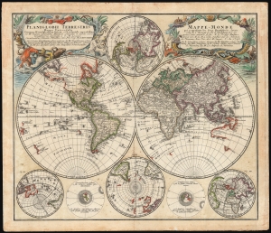
Planiglobii Terrestris/ Mappe-Monde.
$1,500.00
Acquire
- Digital Map Information
- Suitable for large format printing
- File Size: 29.97 MB
- File Type: ZIP / TIFF
- ICC color profile embedded
- Delivered instantly via download link
This is an elegant and detailed 1759 world map by Johann Matthias Hase and Georg Maurice Lowitz, contributors to the firm of Homann Heirs. The map was first issued in 1746, reflecting the best available cartographic detail of the day both from French and Russian sources. The present example was updated c. 1759 to reflect the discoveries of Bering and Chirikov according to the 1754 Müller map, confirming the separation of the continents of Asia and North America. (more details)