
Luillier, Jan

Jan Luillier, also L'huillier (fl 1655-1731) was a Dutch engraver - or quite probably a family of engravers, given the longevity implied by the spread of dates associated with the name. 'J. Lhuillier' and 'J. Luillier' appeared on maps in both Amsterdam and in Paris from as early as 1655 to the first decades of the eighteenth century: this imprint appears on the maps of Sanson, DuVal, De Wit, Mariette, and Danet. Despite the long anf prolific spread of the Luillier name, virtually nothing is recorded about Luillier's (or the Luilliers') life and work.
Sweden at the Height of Empire.
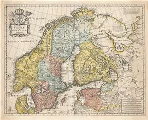
Tabula Regnorum Sueciae et Norvegiae.
$950.00
Acquire
- Digital Map Information
- Suitable for large format printing
- DPI: 600
- File Size: 63.66 MB
- File Type: ZIP / TIFF
- ICC color profile embedded
- Delivered instantly via download link
This is Frederick de Wit's map of Scandinavia. It is based on Anders Bure's 1626 mapping of the region, which swiftly became the dominant mapping of the northern parts of Europe and was not replaced as an authority for more than a century. On the strength of his seminal map and its long tenure as the state-of-the-art map of the northern regions of Europe, Bure is hailed as the Father of Swedish Cartography. The scope of the map includes Denmark, Norway, the greater Swedish Empire, the Baltic coasts of Germany, Poland and Livonia, and the Russian Empire - including 'Lapponia Moscovitica,' the portions of Lapland occupied by Russia. (more details)
Richly-Decorative, Separately-Issued Map of Asia.
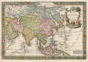
L'Asie Dressée sur de Nouveaux Mémoires Assujettis aux Observations Astronomique.
$2,000.00
Acquire
- Digital Map Information
- Suitable for large format printing
- DPI: 600
- File Size: 95.23 MB
- File Type: ZIP / TIFF
- ICC color profile embedded
- Delivered instantly via download link
This is a separately-issued 1732 Guillaume Danet map of Asia. It is a synthesis of the most advanced cartographic ideas of the age, including from piracies of Strahlenberg's stolen cartography. (more details)