
Pitt, Moses

Moses Pitt (c. 1631 - 1697) was one of the largest British book publishers, printers, and booksellers of the second half of the 17th century. A very ambitious man whose plans eventually led to bankruptcy, Pitt was a small bookseller and publisher before he embarked on some enormous, very expensive ventures. The largest was the English Atlas, which he intended to contain 900 pages of text and 600 plates in eleven volumes, in partnership with Jan Jansson's heir Johannes Waesberger. The first volume was published in 1680, but rising costs meant that only four volumes were completed. Pitt's ambitions did not stop there, as he began a huge property speculation scheme in Westminster and took over the printing office of Oxford University. By 1685, however, he was forced to sell off much of his stock at auction, which marked the end of his print publishing. His final bankruptcy and arrest for debt happened in 1689, and he spent the following eight years in prison, only to be released shortly before his death. In 1691, Pitt published The Cry of the Oppressed: Being a True and Tragical Account of the Unparallel'd Sufferings of Multitudes of Poor Imprison'd Debtors In Most of the Gaols in England, an appeal on behalf of people imprisoned for debt.
Estonia and Latvia as the Swedish Frontier
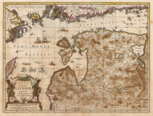
Nova Totius Livoniae accurata Descriptio. Apud Janssonio Waesbergios et Mosem Pitt.
$750.00
Acquire
- Digital Map Information
- Suitable for large format printing
- Full resolution TIFF file
- ICC color profile embedded
- Delivered instantly via download link
A beautifully engraved map of Livonia and the Duchy of Estonia - encompassing much of modern Latvia and Estonia - originally published in Jan Jansson's Atlas and revised for inclusion in Moses Pitt's rare 1680 English Atlas. Derived from Anders Bure's seminal map of the Swedish Empire, it depicts the region during Swedish rule following Sweden's victories over the Polish-Lithuanian Commonwealth. Sweden retained Estonia and Livonia until its defeat by Russia in the Great Northern War (1700 - 1721). (more details)
A gorgeous 17th century map of an important artery in the fur trade.
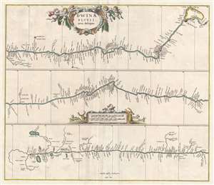
Dwinae Fluvii nova descriptio.
$450.00
Acquire
- Digital Map Information
- Suitable for large format printing
- DPI: 300
- File Size: 7.74 MB
- File Type: ZIP / TIFF
- ICC color profile embedded
- Delivered instantly via download link
This is a 1680 Jan Jansson map of the Northern Dvina River in northern Russia. The map, divided into three sections, follows the course of the river from its source in Vologod Province as it empties into Dvina Bay of the White Sea near Archangel (Arkhangelsk). Several smaller tributaries and towns are identified along the river's banks. (more details)