
Remondini
Remondini (fl. c. 1657 - 1861) were a family of printers who worked originally based in Bassano del Grappa, near Venice. Giovanni Antonio Remondini (1634-1711), the family patriarch, was born in Padua in 1634. In 1657, he took a home the main square of Bassano where he opened a shop drapes, wool, silk and iron tools. He also sold woodcuts of saints which proved popular with local farmers who believed they bought spiritual protection. When Giovanni died in 1711 his printing business fell into the hands of his son, Joseph Remondini. In 1750 Joseph expended the family business into Venice proper. Having several paper factories established by Giovanni Antonio, the Remondini were in a position to undercut competitors in Venice. The Remondini employed a number of talented engravers, including Paolo Santini, an Abbot who specialized in sacred images as well as cartography. Their corpus includes several beautifully produced atlases, though, cartographically speaking, little in the way of original work. The family fell into decline following the Napoleonic invasions, finally closing their doors in 1861. Most of the Remondini family's work is today preserved in the Museum of Bassano del Grappa and the Piccolo Remondini Museum of Vicenza.
Fascinating map the divides the world into terrestrial and maritime hemispheres and argues for a Paris Prime Meridian.
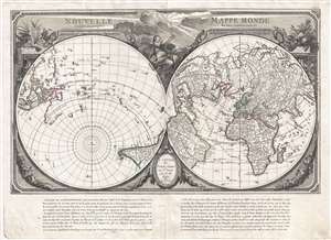
Nouvelle Mappe Monde dedièe au progrès de nos connoissances.
$1,800.00
Acquire
- Digital Map Information
- Suitable for large format printing
- DPI: 300
- File Size: 15.38 MB
- File Type: ZIP / TIFF
- ICC color profile embedded
- Delivered instantly via download link
An impressive and unusual 1784 map of the world on dual polar projections by François Santini and the Remondini family. This map was originally drawn by Nicholas-Antoine Boulanger and published in Paris by Chez R. J. Julien in 1753. Boulanger divides the world ... (more details)
Refining the Map of America's Northwest Coast.
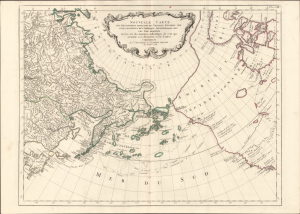
Nouvelle Carte des Decouvertes Faites par des Vaisseaux Russiens aux Cotes Inconnues de l'Amerique Septentrionale avec les Pais Adiacents. Dressée sur des memoires authentiques de ceux Qui ont assisté a ces decouverts, et sur d'autres Connoissances.
$1,000.00
Acquire
- Digital Map Information
- Suitable for large format printing
- Full resolution TIFF file
- ICC color profile embedded
- Delivered instantly via download link
This is Paolo Santini's pirated 1784 edition of Jacob von Staehlin's update to Gerhard Muller's map of the Pacific Northwest, Alaska, the Arctic, and Siberia. It illustrated the findings of Vitus Bering's Great Northern Expedition and subsequent Russian explorations, and was among the most accurate maps of the northwest coast of America available outside Russia before the voyages of Cook, La Pérouse, and Vancouver. (more details)