
Robins, James

James Robins (fl. c. 1816 - 1835) was a publisher of books, prints, and maps based in London in the early 19th century. Details about the company and its founder are scant. The firm may have had a branch in Dublin, operated by Robins' son. Its publications included an atlas of England and Wales, a multi-volume history of England in the reign of George III, and a collection of portraits of 'distinguished characters' of the sort who would appear in freak shows.
The Landscape of Late Georgian London.
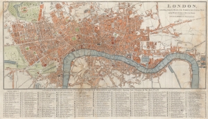
London, extending from the Head of the Paddington Canal West, to the West India Docks East.
$600.00
Acquire
- Digital Map Information
- Suitable for large format printing
- File Size: 18.7 MB
- File Type: ZIP / TIFF
- ICC color profile embedded
- Delivered instantly via download link
A highly-detailed c. 1816 city plan of London, originally prepared by John Russell and published by James Robins and Company. This map captures London at a time of expansion and construction, with numerous new thoroughfares, bridges, and even docks illustrated. (more details)