
Serra y Mas, Pascual

Pascual Serra y Mas (fl. c. 1853 - 1883) was a Spanish line and letter engraver engaged with the Direccion de Hidrografia or Deposito Hidrografico in the second half of the 19th century.
Turbulent Waters.
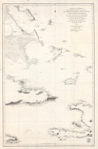
Carta Esferica que comprende parte de las Islas de S.to Domingo, Jamaica, Cuba, Lucayas Y Gran Banco de Bahama.
$1,200.00
Acquire
- Digital Map Information
- Suitable for large format printing
- File Size: 29.79 MB
- File Type: ZIP / TIFF
- ICC color profile embedded
- Delivered instantly via download link
A highly detailed 1856 nautical chart produced by Spain's Dirección de Hidrografía, taking in portions of the Bahamas, Cuba, Haiti, and Jamaica, and their surrounding waters. It was made as Spain tried to develop naval power to maintain a tenuous hold on its remaining American colonies, Cuba and Santo Domingo. (more details)