
Stadelmann, Cölestin

Cölestin Stadelmann (fl. C. 1883 – 1903) was a Basel-based cartographer who primarily worked on maps of his home city and its environs.
A global city, avant la lettre.
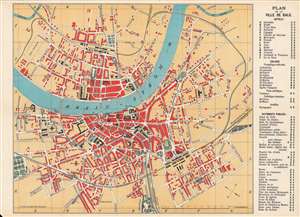
Plan de la ville de Bale / Basel und Umgebung.
$150.00
Acquire
- Digital Map Information
- Suitable for large format printing
- Full resolution TIFF file
- ICC color profile embedded
- Delivered instantly via download link
This is Cölestin Stadelmann's c. 1895 city plan or map of Basel, Switzerland. The front (recto) is a bilingual city plan of Basel (Bâle), while the back (verso) contains a German-language map of the environs of Basel, a reflection of Basel's multilingual environment and international character. (more details)