
Vidal, Alexander Thomas Emeric

Vice Admiral Alexander Thomas Emeric Vidal (1792- 5 February 1863) was an officer of the Royal Navy and an accomplished surveyor. Vidal, the youngest of four children, followed his father into the Navy. He began his naval career in December 1803, at the age of 11, as a 1st class volunteer. He served until 1805 when he joined the Royal Naval College at Portsmouth. He was assigned to the HMS Lavinia and spent three years aboard as a midshipman. He received his first commission in 1815 and was appointed to HMS Leven in 1818 as a first lieutenant under William Fitzwilliam Owen. Vidal accompanied Owen on his voyage to Africa to map the eastern coast. Vidal received his first command in May 1823, while one the expedition with Owen, that of HMS Barracuda.
Vidal spent most of his career as a surveyor, who was charged with several tasks, including locating Aitken’s Rock, a rock supposedly in the North Atlantic. There were at least seven different reports of the potential hazard, stating that it was small and protruded only about four feet from the surface of the ocean. In 1830, Vidal was dispatched to find the rock and accurately chart its location. After six weeks of charting supposed locations, Vidal was unable to locate it. However, during the hunt for Aitken’s Rock, Vidal successfully discovered and charted Vidal bank, and the following year was the first to accurately chart and describe Rockall, a nearly 60 foot high islet in the North Atlantic. The United Kingdom claimed the islet in his name in 1955.
Vidal spent most of his career as a surveyor, who was charged with several tasks, including locating Aitken’s Rock, a rock supposedly in the North Atlantic. There were at least seven different reports of the potential hazard, stating that it was small and protruded only about four feet from the surface of the ocean. In 1830, Vidal was dispatched to find the rock and accurately chart its location. After six weeks of charting supposed locations, Vidal was unable to locate it. However, during the hunt for Aitken’s Rock, Vidal successfully discovered and charted Vidal bank, and the following year was the first to accurately chart and describe Rockall, a nearly 60 foot high islet in the North Atlantic. The United Kingdom claimed the islet in his name in 1955.
Azores - the key the North Atlantic.
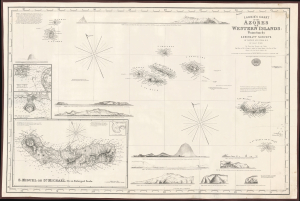
Laurie's Chart of the Azores or Western Islands.
$1,200.00
Acquire
- Digital Map Information
- Suitable for large format printing
- File Size: 2158.46 MB
- File Type: ZIP / TIFF
- ICC color profile embedded
- Delivered instantly via download link
An impressive 1859 blueback nautical map of the Azores and surrounding waters, drawn by Isaac Purdy, based on surveys by Captain A.T.E. Vidal, and published by Richard H. Laurie. This work represents the premier nautical chart of the Azores in the mid-19th century. (more details)