
Allard, Hugo

Hugo Allard (1627-1684) was a Dutch draughtsman, engraver and painter, who worked in Tournai and Amsterdam. His son Carel, (1648-1709) carried on the same trade. Most of his own maps were sold as separate publications, or were collected in composite atlases; consequently they tend to be works of great rarity.
One of the few views of to show a walled New York.
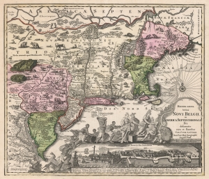
Recens Edita Totius Novi Belgii, in America Septentrionali siti, delineatio cura et sumtibus Tob. Conr. Lotteri, Sac. Caes. Maj. Geographi August. Vind.
$3,500.00
Acquire
- Digital Map Information
- Suitable for large format printing
- DPI: 600
- File Size: 74.88 MB
- File Type: ZIP / TIFF
- ICC color profile embedded
- Delivered instantly via download link
This is Conrad Tobias Lotter's 1757 map of New York, New England, and the mid-Atlantic colonies. It represents the final map in the Jansson-Visscher series. Despite the map's cartography being over a century old, this map continued to capture the idea of this part of the world for Europeans in general and a German audience in particular. (more details)