
Bond, William A.
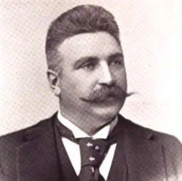
William A. Bond (November 15, 1849 - June 10, 1943) was an American real estate businessman active in Chicago. Born in Newark, New Jersey, Bond moved to Chicago when he was 5 attended public schools in Chicago and then took some college courses. He began working for Hurlbut and Edsell (wholesale druggists), and by the age of 18 was the firm's head bookkeeper. He began working in the real estate business three years later, at the age of 21, in March 1871. The following year, Bond's real estate office burned during the Great Chicago Fire of 1871. Bond reestablished his office after this disaster and continued in the real estate business for the rest of his life. Bond spent 1874 traveling in Europe, where he married Sarah B. Fisher, also from Chicago. When Bond returned in 1875, he established the real estate firm Turner and Bond with Colonel Henry L. Turner. Turner and Bond existed for 17 years, when Bond bought out Turner's interest in the business in 1892. Afterward, the business was called William A. Bond and Company. Bond was a charter member of the Chicago Real Estate Board and was President of the board in 1893, the year of the World's Columbian Exposition.
One of the earliest maps to promote the 1893 Chicago World's Fair.
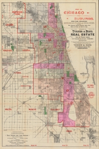
Map of Chicago and Suburbs, Hyde Park, Englewood, South Chicago, Pullman and Other Suburbs, showing Parks, Boulevards, Railroad Connections, Depots, Street Stations and Horse and Cable Car Lines.
$2,000.00
Acquire
- Digital Map Information
- Suitable for large format printing
- Full resolution TIFF file
- ICC color profile embedded
- Delivered instantly via download link
A striking and rare find, this is an 1891 city plan or map of Chicago distributed by the real estate firm Turner and Bond. It is one of the earliest maps, if not the earliest, to promote the 1893 Columbian Exposition (Chicago World's Fair). (more details)