1891 Turner and Bond City Plan or Map of Chicago, Illinois
ChicagoSuburbs-turnerbond-1891$2,000.00


Title
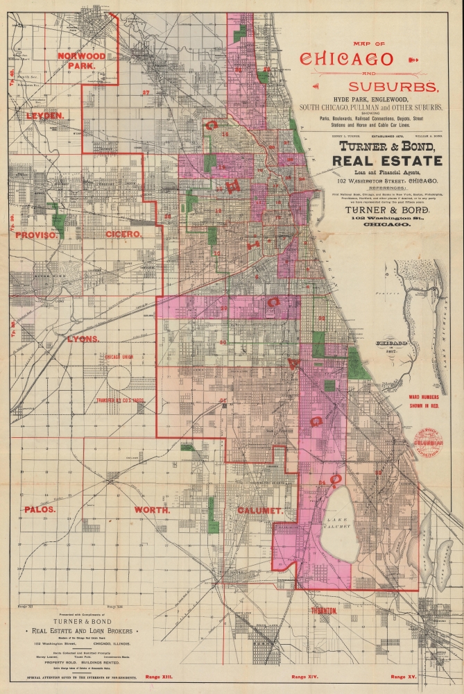
Map of Chicago and Suburbs, Hyde Park, Englewood, South Chicago, Pullman and Other Suburbs, showing Parks, Boulevards, Railroad Connections, Depots, Street Stations and Horse and Cable Car Lines.
1891 (undated) 35 x 23.5 in (88.9 x 59.69 cm) 1 : 54500
1891 (undated) 35 x 23.5 in (88.9 x 59.69 cm) 1 : 54500
Description
A striking and rare find, this is an 1891 city plan or map of Chicago distributed by the real estate firm Turner and Bond. It is one of the earliest maps, if not the earliest, to promote the 1893 Columbian Exposition (Chicago World's Fair).
A Closer Look
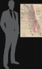
Coverage embraces Chicago from Norwood Park to Sheffield and from West Maywood to Lake George. Red overprinting labels Chicago's wards and suburbs, as well as the Union Stock Yards. An inset map along the right depicts Chicago in 1812, decades before its 1836 founding. This map includes several houses, a fort, and an 'Indian Encampment'.A World's Fair in Planning
While undated, context enables us to date this map between late 1890 and early 1891. This map was clearly issued in anticipation of the 1893 Columbian Exposition - the fair's logo appears in the lower right - marking it as one of the earliest maps to promote the fair. As such, it is of note that the fair's location, Jackson Park, is not emphasized. Chicago was awarded the fair by Congress in 1890, but the exposition site was not settled until 1891 (construction began in 1892). The publisher, Turner and Bond, also ceased operations in 1892 after Bond bought out Turner's interest in the firm.1893 World's Columbian Exposition
The 1893 World's Columbian Exposition or the Chicago World's Fair was a pivotal moment in the history of the United States. Chicago, keen to parade its remarkable recovery from the disastrous 1871 Great Fire of Chicago, won the right to host the World's Fair over New York, Washington D.C., and St. Louis. During its six-month run, nearly 27,000,000 people attended the Columbian Exposition, correlating to roughly half the 1893 population of the United States. Its numerous displays and exhibits established conventions for architecture, design, and decorative arts, and initiated a new era of American industrial optimism. One of its most famous displays was the first Ferris wheel. It was also the first fully electrified global exposition. Over 200 temporary structures filled the grounds (which covered 600 acres) and 47 nations participated.Publication History and Census
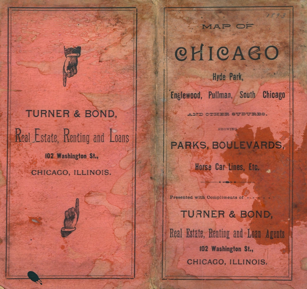
This map was 'presented with compliments of Turner and Bond Real Estate and Loan Brokers' c. 1891. This is the only known example.CartographerS
Henry L. Turner (August 26, 1845 - July 12, 1915) was an American businessman and military officer. Born in Oberlin, Ohio, before the age of 20 Turner had graduated from Oberlin College with honors and had served as an officer in two regiments during the American Civil War (1861 - 1865). First, he served as a lieutenant in the 150th Regiment, Ohio Volunteers, and then as Lieutenant and Adjutant for the 1st Regiment United States Colored troops. He fought in battles at Fort Stevens, the siege of Richmond, the second battle of Fair Oaks, the attack on Fort Fisher, and the capture of General Joseph E. Johnston's Army. After the war, he moved to Chicago, Illinois, where he worked with the 'Advance' newspaper. At some point after that he moved to Philadelphia and worked for Jay Cook and Company, the great banking house. He worked for that firm until it failed in 1873. At this point he returned to Chicago and began working for the 'Advocate' again. He bought the paper and managed it for two years before selling it. Turner moved into the world of real estate in 1874 when he founded the firm Turner and Marsh with his brother-in-law. Marsh (the brother-in-law) soon left the firm in favor of a job in Europe, and Turner began a partnership with William A. Bond, which lasted until 1892 when Turner retired from the business. Upon his retirement, Turner opened a banking investment business, which existed until at least 1900. In 1898, when the Spanish-American War was declared, Turner reentered the military as the commanding officer of the 1st Illinois National Guard, which was soon federalized. They were sent to Santiago, Cuba, and participated in the battle that captured that city. He had been in ill health since suffering from sunstroke during the Spanish-American War. More by this mapmaker...
William A. Bond (November 15, 1849 - June 10, 1943) was an American real estate businessman active in Chicago. Born in Newark, New Jersey, Bond moved to Chicago when he was 5 attended public schools in Chicago and then took some college courses. He began working for Hurlbut and Edsell (wholesale druggists), and by the age of 18 was the firm's head bookkeeper. He began working in the real estate business three years later, at the age of 21, in March 1871. The following year, Bond's real estate office burned during the Great Chicago Fire of 1871. Bond reestablished his office after this disaster and continued in the real estate business for the rest of his life. Bond spent 1874 traveling in Europe, where he married Sarah B. Fisher, also from Chicago. When Bond returned in 1875, he established the real estate firm Turner and Bond with Colonel Henry L. Turner. Turner and Bond existed for 17 years, when Bond bought out Turner's interest in the business in 1892. Afterward, the business was called William A. Bond and Company. Bond was a charter member of the Chicago Real Estate Board and was President of the board in 1893, the year of the World's Columbian Exposition. Learn More...
Condition
Good. Light wear along original fold lines. Verso repairs at fold intersections. Slight loss at a fold intersection. Some dampstaining.