
Bower, John

John Bower (fl. c. 1810 - 1819) was an engraver based in Philadelphia that produced plates for Carey's General Atlas, illustrations for a printing of Isaac Collins' Bible, as well as a depiction of the bombardment of Fort McHenry and portraits of the earliest U.S. Presidents.
North America after the Louisiana Purchase but before Lewis and Clark.
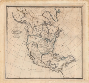
A New and Accurate Map of North America from the best Authorities.
$350.00
Acquire
- Digital Map Information
- Suitable for large format printing
- Full resolution TIFF file
- ICC color profile embedded
- Delivered instantly via download link
An interesting map of North America by Matthew Carey and engraved by John Bower for the 1814 edition of Carey's General Atlas. It reflects the state of geographical knowledge of interior North America at the start of the 19th century, before the discoveries of Lewis and Clark. (more details)