
Catesby, Mark

Mark Catesby (March 24, 1683 - December 23, 1749) was a British artist, scientist, and explorer active in the early to middle parts of the 18th century. He was born at Castle Hedingham, Essex, England, the son of a gentleman farmer and a prominent local politician. John Ray, a famed English naturalist and family, friend inspired Catesby to study natural history. When his father died, in 1712, he accompanied his sister, Elizabeth and her husband William Cooke, a member of the Virginia colony governor’s council, to Virginia. This was his first voyage to the Americas, where he remained for the subsequent 7 years, traveling through Appalachia and to some of the West India Islands, including Jamaica. During his travels he produced meticulous illustrations of the flora and fauna he encountered. On his return to London, the Royal Academy, then headed by Sir Isaac Newton, were so impressed with his work that they raised funds for a second voyage. Catesby returned to the America’s in 1722, arriving in Charleston. In the subsequent 4 years, he traveled throughout the Carolina, Florida, and the Bahamas, observing animal and plant life, and laying the groundwork for his seminal work, The Natural History of Carolina, Florida and the Bahama Islands, considered to be the first fully-illustrated natural history of North America. His work was highly influential, inspiring a new generation of natural historians, including Carl Linnaeus (1707 - 1778) and John James Audubon (1785 - 1851). Catesby died at his home in London where he was buried in the St. Luke Old Street churchyard, aged 66.
Finest colonial-era map of the American southeast.
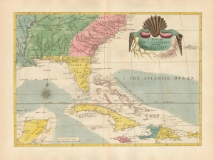
A Map of Carolina, Florida and the Bahama Islands with the Adjacent Parts.
$21,000.00
Acquire
- Digital Map Information
- Suitable for large format printing
- DPI: 600
- File Size: 46.7 MB
- File Type: ZIP / TIFF
- ICC color profile embedded
- Delivered instantly via download link
A beautiful 18th-century example of Mark Catesby’s 1743 map of the southeastern parts of North America. This map is considered one of the finest colonial-era maps of the American southeast. The present example is a 1771 third edition of the map. (more details)