
Chesney, Francis Rawdon
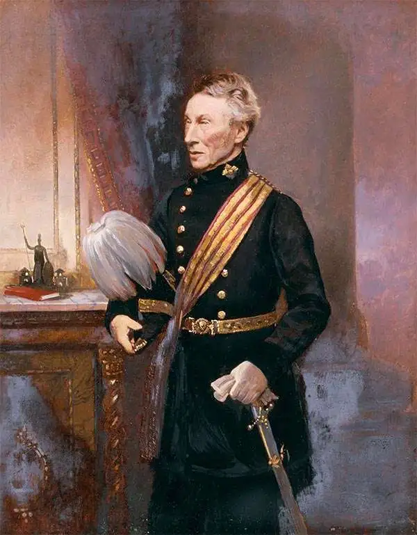
Francis Rawdon Chesney (March 16, 1789 - January 30, 1872) was a British general and explorer. Chesnew was born in Annalong, County Down, Ireland. His father, Alexander Chesney, served Francis Rawdon-Hastings (Lord Rawdon; 1754 - 1826) during the American Revolutionary War (1775 - 1783). Rawdon sponsored the younger Chesney for a cadetship at the Royal Military Academy, Woolwich, and in 1805, he was gazetted to the Royal Artillery. Chesney was stationed in the Middle East, where he rose to prominence, leading an inspection tour of Egypt and Syria. In 1830, he submitted a report on the feasibility of a Suez Canal - it was this report that proved the basis of Ferdinand Marie de Lesseps (1805 - 1894) plans for the Canal. Chesney was confident that the Euphrates was navigable by steamships and would provide an expeditious route to India that did not require rounding Africa. He persuaded Parliament to fund an expedition to this effect, which launched in 1835. Although suffering numerous setbacks, the Expedition was ultimately successful, reaching the Persian Gulf in June 1836, proving that the Euphrates was indeed steam-navigable. Back in England, he was awarded the Royal Geographical Society's Founder's Medal, promoted to Major, and received a commission to compose a detailed account of the Expedition, which was published in 1850 as The Expedition for the Survey of the Rivers Euphrates and Tigris. He served abroad once in 1843 in Hong Kong after the First Opium War (1839 - 1842), after which, in 1847, his period of service complete, he retired to Ireland. He twice returned to the Middle East to work on railway surveys, in 1856 and 1862, but the railway was never built. He died in Ireland in 1872.
Most comprehensive and detailed mid-19th century map of Arabia.

A Map of Arabia and Syria Laid down chiefly from original Surveys Under the Supervision of Leiut. Colonel Chesney, R.A. F.R.S. and drawn by W. H. Plate, L.L.D.
$22,000.00
Acquire
- Digital Map Information
- Suitable for large format printing
- Full resolution TIFF file
- ICC color profile embedded
- Delivered instantly via download link
This is William Henry F. Plate's important 1849 map of Arabia, the Persian Gulf, Syria, and Mesopotamia. The product of a wave of new exploration and surveys in the first half of the 19th century, this map is the most significant and detailed map of Arabia and the Persian Gulf to appear in the mid-19th century. (more details)
Best general mapping of Arabia in Persia - drawn from first hand reports and exploration.
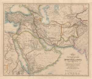
Map of the Counties Situated between the Rivers Nile and Indus; serving as an Inex to the work on the Expedition for hte Survey of the Euphrates and Tigris Drawn from Materials furinished by Lieut. Colonel Chesney R. S. F.R.S.
$12,000.00
Acquire
- Digital Map Information
- Suitable for large format printing
- Full resolution TIFF file
- ICC color profile embedded
- Delivered instantly via download link
This is a 1850 general map of Arabia and Persia, illustrating the route of Rawdon Chesney's Euphrates Expedition (1835 - 1837). Decades before the Suez Canal, Chesney proposed the Euphrates as a viable route for steamers to reach the Persian Gulf and, thus, India, avoiding the dangerous months-long voyage around Africa. The cartography presented is the most advanced general mapping of Arabia and Persia then available, being either directly derived from the 1830s Euphrates Expedition or collected from local sources en route. (more details)