
Colby, George N.

George Nehemiah Colby (January 13, 1846 - 1890) was an American civil engineer and map publisher active in Houlton, Maine in the late 19th century. Colby was born in South Berwick Maine and was married to Julie Gertrude Ganong (1853 – 1889). Colby's corpus of work consists primarily of Maine focused wall maps, county and state atlases, and more specific regional maps, for which he personally compiled surveys and sold by subscription. Colby initially worked with the U.S. Coast Survey, where his work contributed to the survey's important 1881 map of Mount Desert Island, Maine. In the private market Colby published Maine centered material in the style of Massachusetts cartographer Henry Walling. That is to say, he issued highly detailed maps on a large scale that he sold by subscription to local institutions and land owners. Colby's maps, like Walling's, are exceptionally desirable for anyone interested in family history, as they often list individual family names and land holdings. Colby pwartnered Frederick B. Roe in 1873 to issue wall maps of several Maine towns including New Brunswick, Thomaston, Bath, and Camden. This partnership lasted until about 1878 and maintained offices in Philadelphia at 31 South 6th Street. Colby later partnered with Joseph Harry Stuart (1855 - 183?) to similarly publish subscription-based maps and atlases of Maine counties and communities. When Colby retired in the 1890s, Stuart fully took over his business, continuing to publish as J. N Stuart into the 1930s. Colby and his wife had three children, George Nehemiah, Frederik Franklin, and Mary Gertrude.
Powerhouse of American Shipbuilding.
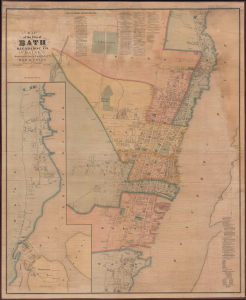
Map of the City of Bath Sagadahoc Co. Maine.
$3,500.00
Acquire
- Digital Map Information
- Suitable for large format printing
- Full resolution TIFF file
- ICC color profile embedded
- Delivered instantly via download link
This is a scarce 1873 wall map of Bath, Maine, prepared by local cartographers Frederick B. Roe and George N. Colby. The map is notable for documenting the city's importance as a center of the American shipbuilding industry. (more details)
One of only two known examples of Colby and Roe's map of Camden, Maine.
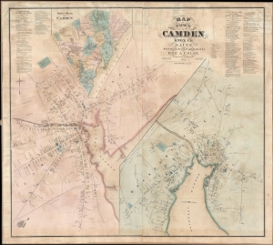
Map of the Town of Camden Knox Co. Maine.
$2,500.00
Acquire
- Digital Map Information
- Suitable for large format printing
- File Size: 43.9 MB
- File Type: ZIP / TIFF
- ICC color profile embedded
- Delivered instantly via download link
A discovery of exceptional rarity, this is Frederick B. Roe and George Nehemiah Colby's 1875 map of Camden, Maine. This is the best and finest map of Camden to appear in the 19th century. It superseded the 1856 E. M. Woodford map of the same region both in terms of size and level of detail. (more details)