
Colby, George N. (sold)

George Nehemiah Colby (January 13, 1846 - 1890) was an American civil engineer and map publisher active in Houlton, Maine in the late 19th century. Colby was born in South Berwick Maine and was married to Julie Gertrude Ganong (1853 – 1889). Colby's corpus of work consists primarily of Maine focused wall maps, county and state atlases, and more specific regional maps, for which he personally compiled surveys and sold by subscription. Colby initially worked with the U.S. Coast Survey, where his work contributed to the survey's important 1881 map of Mount Desert Island, Maine. In the private market Colby published Maine centered material in the style of Massachusetts cartographer Henry Walling. That is to say, he issued highly detailed maps on a large scale that he sold by subscription to local institutions and land owners. Colby's maps, like Walling's, are exceptionally desirable for anyone interested in family history, as they often list individual family names and land holdings. Colby pwartnered Frederick B. Roe in 1873 to issue wall maps of several Maine towns including New Brunswick, Thomaston, Bath, and Camden. This partnership lasted until about 1878 and maintained offices in Philadelphia at 31 South 6th Street. Colby later partnered with Joseph Harry Stuart (1855 - 183?) to similarly publish subscription-based maps and atlases of Maine counties and communities. When Colby retired in the 1890s, Stuart fully took over his business, continuing to publish as J. N Stuart into the 1930s. Colby and his wife had three children, George Nehemiah, Frederik Franklin, and Mary Gertrude.
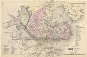
City of Portland and Vicinity Cumberland Co. Me.
sold
- Digital Map Information
- Suitable for large format printing
- File Size: 3.56 MB
- File Type: ZIP / TIFF
- ICC color profile embedded
- Delivered instantly via download link
An uncommon 1885 map of Portland Maine by Gorge N. Colby and his partner J. H. Stuart. The map covers most of downtown Portland and Portland Harbor. Includes adjacent towns of Deering, Cape Elizabeth, Cash Corner, and Ligonia. Portly is presented in ... (more details)
Detailed city map of Portland, Maine.
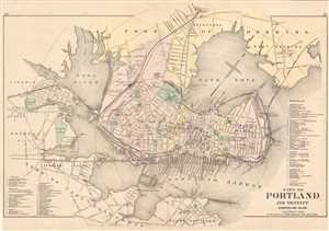
City of Portland and Vicinity Cumberland Co. Me.
sold
- Digital Map Information
- Suitable for large format printing
- File Size: 12.11 MB
- File Type: ZIP / TIFF
- ICC color profile embedded
- Delivered instantly via download link
This is an 1885 Gorge N. Colby and J. H. Stuart map of Portland, Maine. The map depicts from Liconia to East Deering and from Woodfords to South Portland. Portland is illustrated in dtail, with streets and buildings labeled, along with rail lines and ... (more details)
Best and largest map of Mount Desert Island at the height of its Gilded Age.
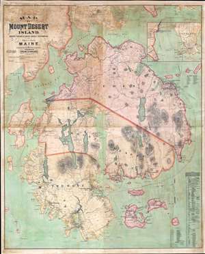
Map of Mount Desert Island, Sorrento, Portions of Lamoine, Hancock, and Frenchman's Bay, and Adjacent Islands, Maine.
sold
- Digital Map Information
- Suitable for large format printing
- File Size: 146.81 MB
- File Type: ZIP / TIFF
- ICC color profile embedded
- Delivered instantly via download link
The largest, rarest, and most important map of Mount Desert Island, Maine, to appear in the 19th century. Published by Colby and Stuart in 1887, this wall map captures Mount Desert Island and Bar Harbor at the height of its gilded age, when it rivaled Newport as a haven for the moneyed elite. The map embraces the island in exceptional detail, showing topography and roads, as well as property lots, the named estates of the wealthy, grand hotels, lodges, restaurants, and more. Today, most of Mount Desert Island is part of Acadia National Park, one of America's most beloved and beautiful national parks. (more details)
A nature lover's paradise!
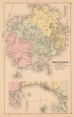
Mount Desert and Adjacent Islands embracing the Towns of Eden, Mount Desert, Tremont, and Cranberry Isles Hancock County, Maine.
sold
- Digital Map Information
- Suitable for large format printing
- File Size: 35.81 MB
- File Type: ZIP / TIFF
- ICC color profile embedded
- Delivered instantly via download link
Popularized as a vacation destination during the 19th century, Mount Desert Island is renowned for its exceptional natural beauty. First brought to public attention by painters of the Hudson River School, tourists and nature lovers began flocking to the island in the 1860s. By 1880, ten years before the present map was published, the island hosted thirty hotels all vying for tourist dollars. By the 'Gay Nineties', American social elites and business magnates, including the Rockefellers, Fords, Vanderbilts, and Carnegies, built summer homes on the islands' most desirable land. Eventually the Rockefellers acquired most of the island, donating it to the Federal government as a public recreation area, Acadia National Park. (more details)