
Delarochette, Louis Stanislaw d'Arcy

Louis Stanislaw d'Arcy Delarochette (1731 - 1802) was a British cartographer and engraver active in London, England in the late 18th century. Delarochette produced numerous maps in conjunction with various other contemporary British cartographers including Faden, Jefferys, Laurie and Whittle, Arrowsmith, and Bowles. Delarochette is perhaps best known for his monumental eight sheet map of South America, which was used to settle numerous border disputes throughout the continent. He also produced an influential map of the Cape of Good Hope, a fine map of the West Indies, and worked with Sayer and Kitchin on their A new map of North America wherein the British Dominions in the continent of North America, and on the islands of the West Indies, are carefully laid down from all the surveys, hitherto made...
The British Colonies on the cusp of Revolution.
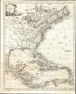
British Empire in North America with the West India Isles.
$2,400.00
Acquire
- Digital Map Information
- Suitable for large format printing
- File Size: 15.2 MB
- File Type: ZIP / TIFF
- ICC color profile embedded
- Delivered instantly via download link
This is Thomas Kitchin's 1770 map of the British Empire in North America, presenting the state-of-the-art mapping of the Colonies on the cusp of the American Revolutionary War (1775 - 1783). It combines the foundational cartography of John Mitchell (north) with the still-authoritative work of Jean-Baptiste Bourguignon d'Anville (south). (more details)
On the cusp of the American Revolutionary War.
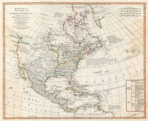
Bowles's New Pocket-Map of North America, Divided into it's Provinces, Colonies, etc,. by J. Palairet, Geographer; lately Revised and Improved with Many Additions from D'Anville, Mitchell, and Bellin, by L. Delarochette.
$2,500.00
Acquire
- Digital Map Information
- Suitable for large format printing
- DPI: 600
- File Size: 46.4 MB
- File Type: ZIP / TIFF
- ICC color profile embedded
- Delivered instantly via download link
This is a c. 1771 Carington Bowles map of North America, published just 4 years prior to the American Revolutionary War (1775 - 1783). The map depicts the increasingly complex and unstable political situation following the French and Indian War (1754 - 1763). It further illustrates ambitions for an inland Northwest Passage via Hudson Bay, and speculations about a great 'Sea of the West' dominating the Pacific Northwest - one of the last and greatest cartographic myths of the 18th century. (more details)
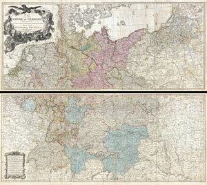
Map of the Empire of Germany, Including All the States Comprehended under that Name: with the Kingdom of Prussia, &c.
$1,850.00
Acquire
- Digital Map Information
- Suitable for large format printing
- DPI: 300
- File Size: 80.78 MB
- File Type: ZIP / TIFF
- ICC color profile embedded
- Delivered instantly via download link
An absolutely stunning and monumental two panel 1794 wall map of Germany, Bohemia, Austria and Prussia by Louis Stanislas d'Arcy Delarochette. Covers Germanic territories in full from the Baltic Sea to the Gulf of Venice. Includes Germany, Austria, Bohemia (Czech ... (more details)