
d'Heulland, Guillaume

Guillaume d'Heulland (c. 17?? - 1770) was a prolific French engraver active in Paris during the mid-18th century; his known work spans from 1731 to 1766. Most of his work focuses on maps, scientific diagrams, and architectural plans. He engraved nautical charts for the French Royal Navy; he engraved many maps and charts for Jacques Nicolas Bellin (1703 - 1772), as well as for Pierre François Xavier de Charlevoix (1682 – 1761), César-François Cassini de Thury (1714 - 1784), and Antoine-François Prevost (1697 - 1763). He appears to have engraved most, if not all of the charts for D'Après de Mannevillette's 1745 Neptune Oriental. He is perhaps best known for his 1756 Plan of Paris. The engraver Choffard was one of his apprentices.
Suppressed and groundbreaking first edition!
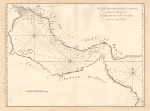
Plan Particulier du Golfe de Perse depuis le Caps de Rosalgatte et de Jasque, jusqu'à Bassora.
$2,500.00
Acquire
- Digital Map Information
- Suitable for large format printing
- DPI: 600
- File Size: 15.3 MB
- File Type: ZIP / TIFF
- ICC color profile embedded
- Delivered instantly via download link
This is the suppressed and thus extremely rare 1745 first edition of D'Après de Mannevillette's (1707 - 1780) groundbreaking map of the Persian Gulf. It is perhaps the earliest European map of the Persian Gulf based on actual navigation and is nearly unobtainable to the collector. (more details)
Extremely rare, suppressed first edition of a groundbreaking chart.
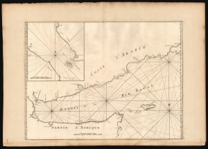
[Untitled chart of the Gulf of Aden].
$950.00
Acquire
- Digital Map Information
- Suitable for large format printing
- DPI: 600
- File Size: 75.74 MB
- File Type: ZIP / TIFF
- ICC color profile embedded
- Delivered instantly via download link
This is the extremely rare 1745 first edition of D'Après de Mannevillette's groundbreaking nautical chart of the Gulf of Aden. Although censured by the French Admiralty and thus exceedingly scarce, this map represents one of the earliest scientific measurements of these coastlines. (more details)
Suppressed and groundbreaking first edition!
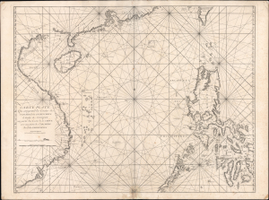
Carte Plate Qui comprend les Coste de Tsiompa, de la Cochinchine, le Golfe de Tunquin, une partie des Costes de la Chine aves une partie de l'Archipel des Isles Philippines.
$5,500.00
Acquire
- Digital Map Information
- Suitable for large format printing
- File Size: 47.63 MB
- File Type: ZIP / TIFF
- ICC color profile embedded
- Delivered instantly via download link
This is the exceedingly rare 1745 nautical map of the South China Sea and the Philippines, which appeared in Mannevillette's banned first edition of his groundbreaking nautical atlas, the Neptune Oriental. When published, this chart represented the finest available cartography of the South China Sea, Southeast China Coast, and the Philippines - thus defining the Canton-Macao-Manila triangle. It was so accurate that French authorities, fearing for the security of their colonial empire, ordered all examples banned and destroyed. The map is additionally notable for its early and idiosyncratic inclusion of various islands, banks, and atolls in the area, many of which have become hotly disputed in recent decades. (more details)