
Folque, Filipe de Sousa
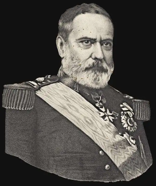
Filipe de Sousa Folque (November 28, 1800 - Decemer 27, 1874) was a Portuguese aristocrat, politician, civil and military engineer, and mathematician active in the middle to late 19th century. Folque was born in Portalegre, the son of son of Pedro Fulque (1744 - 1848), also a military engineer. He studied mathematics at the University of Coimbra, graduating in 1826. In 1833, he joined the Portuguese navy, transferring to the army shortly after to become Lieutenant of Engineers. From 1836 he became director of the Academia de Marinha. In that year he created a hydrographic engineer curriculum that significantly advance exposure of naval officers to astronomy, geodesy, topography, hydrography, and cartography. In 1840, he was appointed professor of astronomy and geodesy at the Escola Politécnica de Lisboa. In 1843, Folque, along with his father, were chosen by Maria II to revolutionize the mapping of Portugal as head of a new national topogrpahical survey (1:100000). In 1851, he took over the direction of a new hydrographic department, which for a long time depended on the Direcção Geral dos Trabalhos Geodésicos. As a member of the Academia Real das Ciências, he tough mathematics to the daughters of Queen Maria II (1819 - 1853). Folque was also appointed to head a new meticulous survey of Lisbon in 1856. For his services, Folque was offered a noble title, which he refused so that it could be passed to his son-in -law, who was named Conde de Nova Goa. He died at the age of 74 in Lapa (Lisbon)
Revolutionary 19th century map of Lisbon.
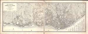
Carta Topographica da Cidade de Lisboa e sus Arredores referida a 30 de junho de 1876.
$18,000.00
Acquire
- Digital Map Information
- Suitable for large format printing
- File Size: 38.82 MB
- File Type: ZIP / TIFF
- ICC color profile embedded
- Delivered instantly via download link
An outstanding 1878 first-edition large scale map of Lisbon, Portugal - this is largest and best printed map of Lisbon to appear in the second half of the 19th century, and the definitive plan of that city during the transformative Fontismo period. The map is presented in two enormous sections, which, if joined, would measure some 90 inches wide. It reveals individual city blocks, streets, and public squares, and in many cases, names individual buildings. Overprinting in orange ink - doubtless a separate printing plate, offers contours illustrating Lisbon's dramatic topography. (more details)