
Jagen, Jan van

Jan van Jagen (1709 - 1800) and Carl van Jagen were active engravers based in Amsterdam. The Jagens were active throughout the 18th century and are known to have engraved maps for such prominent Dutch firms as Ottens, De La Feuille and Ratelband. Despite a fairly large corpus of work, little else is known of these elusive figures.
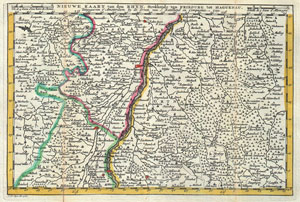
Nieuwe Kaart van den Rhyn, Strekkende van Fribourg tot Haguenau.
$225.00
Acquire
- Digital Map Information
- Suitable for large format printing
- DPI: 300
- File Size: 3.66 MB
- File Type: ZIP / TIFF
- ICC color profile embedded
- Delivered instantly via download link
A stunning map of Alcase, France drawn by J. Ratelband in 1735. Includes both Basse Alsace and Haute Alsace. Covers from Fribourg in the northwest, eastward past Strasbourg and the Rhine River as far as Rordorff and Kilberg. Dutch language title along the top ... (more details)