
Jean, Pierre

Pierre Jean (1754 - 1829) was a French engraver, publisher, print seller, and map maker active in Paris in the late 18th and early 19th centuries. Jean entered the engraving and printing business on June 7 of 1784 when he married the daughter of Louis-Joseph Mondhare, a prominent French engraver, print seller and map publisher. Mondhare changed the name of his firm to Mondhare & Jean. Under Mondhare, for about 12 years, Jean mastered the in-and-outs of the engraving and map publishing business. Mondhare retired in 1796, leaving Jean his business and printing plates. Jean subsequently continued to publish on his own account, as Chez Jean, from the old Mondhare & Jean offices at 32 Rue Saint-Jean de Beauvais.
Reorder Europe after Napoleon.
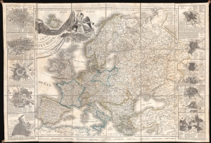
Carte Itinéraire et Politique D'Europe d'après les derniers traités de paix, avec les Plans des principales villes d'Europe.
$650.00
Acquire
- Digital Map Information
- Suitable for large format printing
- Full resolution TIFF file
- ICC color profile embedded
- Delivered instantly via download link
A large-scale 1836 map of Europe by Nicolas Maire, issued in the heady years of the early 19th century, when Europe, still reeling from the Napoleonic Wars (1803 - 1815), politically redefined itself. (more details)