
Jean, Pierre (sold)

Pierre Jean (1754 - 1829) was a French engraver, publisher, print seller, and map maker active in Paris in the late 18th and early 19th centuries. Jean entered the engraving and printing business on June 7 of 1784 when he married the daughter of Louis-Joseph Mondhare, a prominent French engraver, print seller and map publisher. Mondhare changed the name of his firm to Mondhare & Jean. Under Mondhare, for about 12 years, Jean mastered the in-and-outs of the engraving and map publishing business. Mondhare retired in 1796, leaving Jean his business and printing plates. Jean subsequently continued to publish on his own account, as Chez Jean, from the old Mondhare & Jean offices at 32 Rue Saint-Jean de Beauvais.
Lisbon, 20 years before its catastrophic destruction.
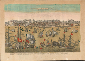
Lisbone / Lisbone, Ville Capitale du Royaume de Portugal, située à l'Embouchure du Tage.
sold
- Digital Map Information
- Suitable for large format printing
- Full resolution TIFF file
- ICC color profile embedded
- Delivered instantly via download link
This lively, attractive waterfront panorama of Lisbon, engraved by Étienne Charpentier around 1736, captures the bustling capital of Portugal just shy of 20 years before the city was destroyed in the cataclysmic 1755 earthquake and tsunami. (more details)
Detailed and attractive map of Madrid, Spain.
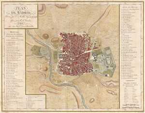
Plan de Madrid.
sold
- Digital Map Information
- Suitable for large format printing
- DPI: 300
- File Size: 6.74 MB
- File Type: ZIP / TIFF
- ICC color profile embedded
- Delivered instantly via download link
This is a 1782 Edme Mentelle map or plan of Madrid, Spain. This map depicts the city of Madrid from the Manzanares River in the west to the Campo Grande in the east and from the Puerta de Embaxadores in the south to the Puerta des los Pozos in the north as well as ... (more details)
Only map recognized by the Assemblée Nationale.
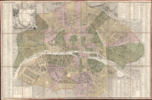
Plan de la Ville et Faubourg de Paris Divisé en ses 48 Sections Decreté par l'Assemblée Nationale le 22 Juin 1790 et Sanctionné par le Roi.
sold
- Digital Map Information
- Suitable for large format printing
- DPI: 600
- File Size: 80.24 MB
- File Type: ZIP / TIFF
- ICC color profile embedded
- Delivered instantly via download link
A stunning 1790 Louis-Joseph Mondhare and Pierre Jean Revolutionary-Era city map of Paris, France - this is the only map the Assemblée Nationale recognized to delineate its newly created sections within Paris. The map was printed by order of the Assemblée Nationale a year the Storming of the Bastille and the outset of the French Revolution (1789 - 1799). (more details)
Extraordinary large format case map of Revolutionary Period Paris, France.
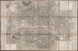
Plan de la Ville et Faubourg de Paris Divise en 12 Municipalites.
sold
- Digital Map Information
- Suitable for large format printing
- Full resolution TIFF file
- ICC color profile embedded
- Delivered instantly via download link
An extraordinary map of pre-Haussmann Paris and the early Faubourgs (suburbs) issued in 1797, during the final days of the Directory and the French Revolution and just two years before rise of Napoleon Bonaparte. Covers Paris on both sides of the Seine from the ... (more details)
An ephemeral map of Paris showing Napoleon's division of the city into 12 Municipalities.
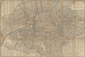
Plan Routier de la Ville et Faubourg de Paris Divise en 12 Municipalities.
sold
- Digital Map Information
- Suitable for large format printing
- DPI: 300
- File Size: 36.5 MB
- File Type: ZIP / TIFF
- ICC color profile embedded
- Delivered instantly via download link
An extraordinary map of pre-Haussmann Paris and the early Faubourgs (suburbs) issued in 1802, following Napoleon Bonaparte's 1800 reorganization of the city into 12 Municipalities. Covers Paris on both sides of the Seine from the Champ de Mars to Le Trone, ... (more details)
The end of Napoleon's reign.
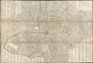
Plan Routier de la Ville et Faubourgs de Paris divisé en douze Mairies.
sold
- Digital Map Information
- Suitable for large format printing
- Full resolution TIFF file
- ICC color profile embedded
- Delivered instantly via download link
This is an 1814 Chez Jean city plan or map of Paris, France. The map captures Paris on the cusp of transformation, just prior Emperor Napoleon Bonaparte's defeat (1814/15) and the Bourbon Restoration. The map significantly predates the major reforms and retrogressions of the Bourbon Restoration (1814 - 1830). Celebrated Parisian landmarks, including Napoleon's Arc de Triomphe at the Place de l'Étoile, the Louvre, the Jardin des Tuileries, and Notre Dame, all appear. Street indexes occupy three of the four corners, with the title occupying the fourth. (more details)
Between revolutions.
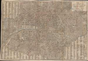
Plan Routier de la Ville et Fauxbourgs de Paris divisé en douze Mairies.
sold
- Digital Map Information
- Suitable for large format printing
- File Size: 48.18 MB
- File Type: ZIP / TIFF
- ICC color profile embedded
- Delivered instantly via download link
This is a striking 1824 Eustache Hérisson city plan or map of Paris, France. Centered on the Ile de la Cité, this map depicts central Paris from the Champ de Mars and the Arc de Triomphe to the Place du Trone (Place de la Nation), and from the Hôpital St. Louis to the Observatoire de Paris. The map illustrates gardens, important buildings, cemeteries, parks, streets, public places, bridges, and twelve districts, or Maries. Surrounding the map is a comprehensive street index. This is the Paris of Victor Hugo, Théodore Rousseau, and Jean-Pierre Dantan. (more details)
The Paris of Victor Hugo and the June Rebellion.
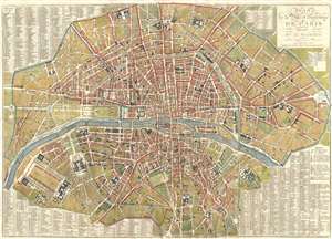
Plan de la Ville et Faubourgs de Paris, Divise en 12 Mairies.
sold
- Digital Map Information
- Suitable for large format printing
- DPI: 300
- File Size: 25.78 MB
- File Type: ZIP / TIFF
- ICC color profile embedded
- Delivered instantly via download link
A stunning large 1833 map of Paris, France, by Eustache Hérisson. Centered on the Ile de la Cité, this map covers central Paris from the Champ de Mars and the Arc de Triomphe to the Place du Trone (Place de la Nation), and from the Abattoir to the ... (more details)