
Lay, Amos

Amos Lay (1765 - 1851) was an American surveyor, cartographer, and engraver active in New York in the late 18th and early 19th centuries. Lay was born in New Hampshire. He began his career as a survey in Vermont and New Hampshire, where he worked as a land agent promoting properties in Ontario. He surveyed along the St. Lawrence in Franklin and St. Lawrence counties. His first map, published in 1801, is a large format map of New York compiled with Arthur J. Stansbury. He subsequently issued a larger map of New York in 1812, and in 1827, a large wall map of the United States.
Important content for Texas and Florida.
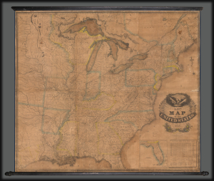
Lay's Map of the United States Compiled from the Latest and best Authorities and Actual Surveys.
$3,500.00
Acquire
- Digital Map Information
- Suitable for large format printing
- DPI: 600
- File Size: 400.53 MB
- File Type: ZIP / TIFF
- ICC color profile embedded
- Delivered instantly via download link
This 1832 Amos Lay map of the United States is one of the earliest and largest American wall maps. It features significant content regarding early grants in Texas and Florida, as well as a contemporaneous depiction of America's Canal Age. (more details)