
Lippincott, Joshua Ballinger
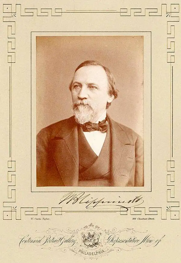
Joshua Ballinger Lippincott (March 18, 1813 - 1886) was the founder of J. B. Lippincott and Co. (1836-2002), an American publishing house founded in Philadelphia, Pennsylvania in 1836. Lippincot was born in Juliustown, New Jersey. He relocated to Philadelphia in 1827 where he worked at Clark's Bookstore (1827 - 1836). Clark's went bankrupt in 1836 and in the same year Lippincott started his own company. Meeting with considerable success, in 1849, he acquired the entire stock of the publishing house Grigg, Elliott, and Company. This acquisition positioned Lippincott as the primer publisher in Philadelphia. The next year, 1850, the firm reorganized and took a a new partner, Grumbo, emerging as Lippincott, Grumbo, and Company. In 1855, the partner Grumbo retired and the company name reverted to J.B. Lippincott and Company. He founded Lippincott’s Magazine in 1868 and the Medical Journal a few years later. In 1875, Lippincott founded an agency in London to import European literature into the United States. During his life he was a director of the Reading Railroad, the Philadelphia Saving Bank, the Union League Club, and the Academy of Fine Arts, as well as a trustee of the University of Pennsylvania. His firm became the J. B. Lippincott Company in 1878, and was subsequently acquired by Harper and Row Publishers in 1978. In 1995, Wolters Klumer N.V. of the Netherlands purchased the company, which became Lippincott-Raven Publishers in 1996 and Lippincott Williams and Wilkins in 1998. In 2002, the firm ceased to exist and became Wolters Kluwer Health.
Gorgeous geological map of North America illustrating Gilpin's climate theories.
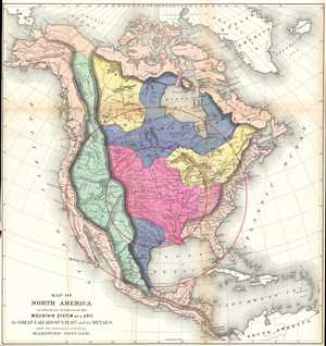
Map of North America in which are delineated the Mountain System as a Unit, the Great Calcareous Plain and its Details, and the continuous encircling Maritime Selvage.
$500.00
Acquire
- Digital Map Information
- Suitable for large format printing
- File Size: 14.62 MB
- File Type: ZIP / TIFF
- ICC color profile embedded
- Delivered instantly via download link
This is an 1873 William Gilpin geological map of North and Central America. The map depicts from the Arctic Ocean to South America and from the Pacific to the Atlantic. This map is the second map from Gilpin's book Mission of the North American People . Gilpin ... (more details)
Gilpin's strange climate theories.
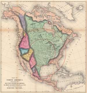
Map of North America delineating the Mountain System and its Details, the Great Calcareous Plain as a Unit, and the continuous encircling Maritime Selvage.
$400.00
Acquire
- Digital Map Information
- Suitable for large format printing
- File Size: 39.48 MB
- File Type: ZIP / TIFF
- ICC color profile embedded
- Delivered instantly via download link
This is an 1873 William Gilpin geological map of North and Central America. This map is the first map from Gilpin's book Mission of the North American People. A beautifully colored map, two different 'systems' are illustrated: the mountain system in detail and the 'Great Calcareous Plain' as a 'unit'. Thus, no division is illustrated between different regions of the 'Great Calcareous Plain', whereas regional differences in the mountains of North America are depicted with color. Several concentric circles are meant to show 'maritime selvage'. Our research did not provide us with a satisfactory explanation of this phrase. (more details)