
National Survey Authority of Oman
National Survey Authority of Oman (الهيئة الوطنية للمساحة ; c. 1984 - present), abbreviated as NSA and now known as the National Survey and Geospatial Information Authority (NSGIA), is the primary government body responsible for national mapping, geodetic control, and maintaining the geographic archives of the Sultanate. The NSA was established in October 1984 as an agency within the Ministry of Defence. It was created to centralize, standardize, and regulate all military and civilian surveying activities across Oman, replacing a patchwork of domestic and foreign military surveys (namely, those by the UK's Directorate of Military Survey and the Royal Air Force), oil company data, and departmental mapping efforts. In the years after its creation, the NSA's work has been supplemented by additional government bodies such as the National Hydrographic Office and Ministry of Housing (which manages the land cadaster).
Transformation of Oman.
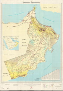
سلطنة عمان / [Sultanate of Oman]. / المجموعة: عمان متنوعة ٠٦, الطبعة: هـ و م ٠٤ / [Series: Oman Miscellaneous 06, Edition: National Survey Authority 04].
$500.00
Acquire
This is a large-format 1994 map of the Sultanate of Oman prepared by the country's National Survey Authority. It depicts the country during a period of rapid change and modernization under Sultan Qaboos, who would go on to lead the Sultanate for 50 years and fundamentally transform it. The map's production reflects these developments, as the National Survey Authority had existed for only a decade when it was issued. (more details)