
Pouchot de Maupas, Pierre

Pierre Pouchot de Maupas (April 8, 1712 – May 8, 1769) was a French historian, military engineer, and army officer in the French regular army active in Europe during the War of Austrian Succession and in America during French and Indian War. Pouchot was born in Grenoble, France, the son of a merchant. He joined the army at 21 as a volunteer engineer and was appointed second lieutenant in the Régiment de Béarn on May 1 of 1734. During the War of the Austrian Succession, his engineering service earned him a Cross of the Order of St. Louis and, in September 1748, a commission as Captain. Later, during the French and Indian War, he was assigned to the Canadian theater, serving at Fort Frontenac (Kingston, Ontario) and Fort Niagara (Youngstown, NY), where his engineering expertise helped to shore up the crumbling defenses. In July and August of 1756, his unit was assigned to lay out the siege works for the Battle of Fort Oswego (Chouaguen), in upstate New York. Afterwards, he moved between forts, including Frontenac, Ticonderoga, Montreal, Niagara, and Rouillé (Toronto), as needed. He developed strong relationships with France's American Indian allies especially the Cayuga, Onodaga, Delaware, Shawnee, Mississagua, and Seneca who called him Sategariouaen or Sategayogen, meaning 'the center of good transactions.' He was nonetheless captured by the British following Sir William Johnson's successful siege of Fort Niagara. Johnson treated him as a gentleman and, it is said, before Pouchot returned to Montreal from New York, he hosted a dinner party for the British officers. After the war he returned to France, where he compiled an important memoire of the French and Indian War, Mémoires sur la dernière guerre de l'Amérique septentrionale entre la France et l'Angleterre, considered the most accurate French perspective narrative of the war from an actual soldier. Later, he joined French forces occupying of Corsica. There, in 1769, while reconnoitering a post, he was killed. His memoire was published posthumously in 1781.
Unique French perspective on the French and Indian War.
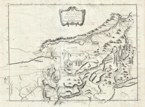
Carte des Frontieres Francoises, et Angloises dens le Canada depuis Montreal jusques au Fort du Quesne.
$2,900.00
Acquire
- Digital Map Information
- Suitable for large format printing
- DPI: 300
- File Size: 7.05 MB
- File Type: ZIP / TIFF
- ICC color profile embedded
- Delivered instantly via download link
A remarkable 1758/1781 idiosyncratically engraved map offering a uniquely French perspective on the French and Indian War (1754 - 1763). It is based on the first-hand experiences of French engineer Pierre Pouchot de Maupas. (more details)