
Service géographique de l'Indochine

Service Géographique de l'Indochine (1899 - c. 1954) was created by decree on July 5, 1899. A Lieutenant Colonel Lubanski, from the Service Géographique de l'Armée, was put in charge. He along with several other army officers, as well as trained topographers and other geographers, immediately began applying the cutting-edge scientific practices employed by the Service Géographique de l'Armée in France to Indochina. They were tasked with creating detailed new maps of the colony. The Service Géographique immediately began mapping the Tonkin and Than-hoa deltas in extreme detail, and published annually a report on their progress. As for the rest of the country, which was sparsely populated and frequently inaccessible jungle, much less detailed maps were deemed sufficient. The Service Géographique also published an Atlas of Indochina annually from 1920 until at least 1932, as well as a summary of their work, which was published annually from 1900. Although the historical record is unclear, it is likely that the Service Géographique was disbanded during the Japanese occupation of Indochina during World War II and reconstituted after the Japanese defeat. During the 1950s the Service Géographique benefited from aerial photography.
Manuscript map of Saigon made for an artillery officer.
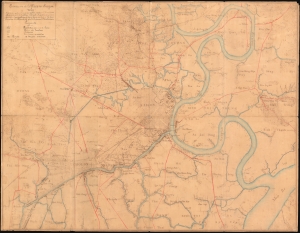
Environs de la Place de Saigon.
$4,500.00
Acquire
- Digital Map Information
- Suitable for large format printing
- File Size: 30.79 MB
- File Type: ZIP / TIFF
- ICC color profile embedded
- Delivered instantly via download link
An exceptional, highly detailed combination ferro-gallic and manuscript map of Saigon (Ho Chi Minh City), Vietnam, prepared in 1904 for Lieutenant Chantereau, an officer serving with the Artillerie Coloniale. The map captures Saigon at its peak as a colonial capital. (more details)
Early urbanization of Phnom Penh.
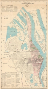
Royaume du Cambodge Plan de la Ville de Phnom-Penh.
$6,500.00
Acquire
- Digital Map Information
- Suitable for large format printing
- File Size: 56.26 MB
- File Type: ZIP / TIFF
- ICC color profile embedded
- Delivered instantly via download link
This is the only known surviving example of an exceptional c. 1935 wall map of Phnom-Penh, capital of Cambodia - the largest and best map of Phnom-Penh during the peak of its colonial era urbanization and development, thus recording a host of ambitious projects, including canals, parks, new neighborhoods, markets, railroads, and dredging efforts that transformed the swampy flood plain to a national capital. (more details)
Routes of colonial control and resistance.
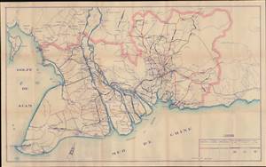
[Untitled map of Southern Vietnam / Cochinchine].
$500.00
Acquire
- Digital Map Information
- Suitable for large format printing
- File Size: 24.62 MB
- File Type: ZIP / TIFF
- ICC color profile embedded
- Delivered instantly via download link
This is a very rare c. 1936 diazio or whiteprint map of roads in Cochinchine, French Indochina that was most likely made by the Service géographique de l'Indochine. It shows the rapidly developing road infrastructure of the colony, built in part to forestall anti-colonial sentiment among the local population. As a diazioprint, production of this map would have been severely limited, so likely no more than 10 - 15 examples were printed. (more details)
Preserving the Many Marvelous Temples of Angkor.
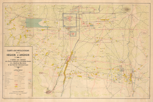
Carte Archéologique de la Région d'Angkor.
$2,500.00
Acquire
- Digital Map Information
- Suitable for large format printing
- File Size: 33.82 MB
- File Type: ZIP / TIFF
- ICC color profile embedded
- Delivered instantly via download link
This is a rare, large-format 1939 archaeological map of Angkor prepared by the Service géographique de l'Indochine. It reflects the culmination of years of surveying and conservation work by the École française d'Extrême-Orient in the early 20th century to document and understand the area's remarkable Khmer temple complexes. (more details)