
Solinus, Gaius Julius
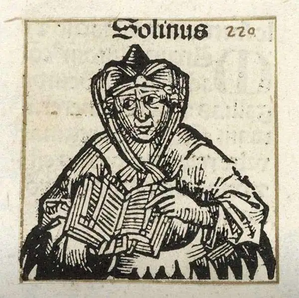
Gaius Julius Solinus (c. 290 - 350) was a Latin grammarian and compiler. His De mirabilibus mundi (The Wonders of the World) survived, recopied well into the 16th century as a valuable description of the ancient world. It touches on social, religious and natural history as understood at the time, drawing heavily from both Pliny's Natural History and Pomponius Mela's Geography. As such, rather than being a mathematical geography in the school of Ptolemy, Solinus' work concerns more the description of places than their physical location. There is considerable debate regarding exactly when Solinus was alive, with scholars putting forth dates nearly up to 100 years apart. I this we are following the scholarship of Fernàndez Nieto, who offers dates from (290 - 350). Some scholars offer a specific death date of January 2, 400, which while possible is unconfirmed.
Münster's first map of Greece.
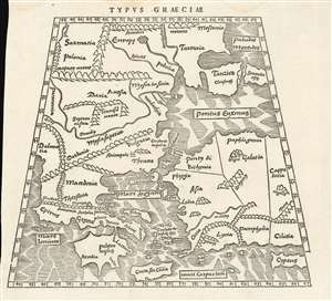
Typus Graeciae.
$600.00
Acquire
- Digital Map Information
- Suitable for large format printing
- Full resolution TIFF file
- ICC color profile embedded
- Delivered instantly via download link
This is a rare 1538 map of Greece and the region surrounding Constantinople, executed by Sebastian Münster for inclusion in his edition of Solinus' Polyhistor. It predates by two years the map of Greece in Münster's 1540 edition of Ptolemy'sGeographia, but it shares with other early maps of Greece the Ptolemaic conic projection. It is a sixteenth century woodcut showing third century geographical knowledge of the region - although at its northern extents, contemporary place names intrude. The map extends from Dalmatia in the west to Cappadocia, Cilicia and Cyprus in the east; it extends from Crete and Cyprus in the south to Poland, Muscovy and Sarmatia in Europe in the north. The Black Sea and the Meotian Swamp (the Sea of Azov) also appear. The map is boldly and legibly presented, with hachured oceans, and with mountains shown pictorially. The cities of Adrianopolis and Constantinople are marked pictorially as well, suggesting their greatness. (more details)