
St. John, Orestes Hawley

Orestes Hawley St. John (1841 - 1921) was a geologist notable for his work with the U.S. Geological and Geographical Survey of the Territories (also known as the Hayden Expedition). He began his career with the Geological Survey of Illinois, with which he was intermittently associated from the 1860s until 1883. He also served as the principal geologist for the Second Geological Survey of Iowa from 1862 to 1868. Given his extensive experience, he was chosen to join the Hayden Expedition and led parties that surveyed the Wind River Mountains, portions of the Gros Ventre Range, the Wyoming Range, and the Snake River Valley.
Surveying the frontier.
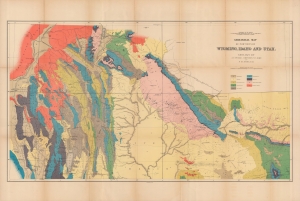
Geological map of portions of Wyoming, Idaho and Utah.
$400.00
Acquire
- Digital Map Information
- Suitable for large format printing
- File Size: 36.93 MB
- File Type: ZIP / TIFF
- ICC color profile embedded
- Delivered instantly via download link
A colorful 1878 geological map of the border region between Wyoming, Idaho, and Utah produced by the U.S. Geological and Geographical Survey of the Territories (USGGST). It was one of several such maps to appear in the Twelfth Annual Report of the USGGST, representing the first detailed geological surveys undertaken in this portion of the American West. (more details)