
Surhon, Jean de

Jean de Surhon (fl. 1550 - 1600) was a Franco-Flemish engraver and cartographer. His father and brother, both named Jacques, were engravers and cartographers as well: his father was also a silversmith. He is remembered for those of his maps which were incorporated in Ortelius' Theatrum Orbis Terrarum: those of Namur (1553), Vermandois (1557), Luxembourg (1551), and Picardy (1557). The original maps do not appear to have survived, and thus Ortelius' versions are the earliest acquirable to the collector. The first, 1570 edition of the Theatrum contained the map of Vermandois: Namur and Picardy first appeared in the 1579 edition. It is a testament to Surhon's maps that no improvement was made to them until the second half of the seventeenth century: Willem Blaeu's atlas would reprise Surhon's work in a faithful, though more beautiful copy of the Ortelius.
Picardy Belongs to the Low Countries, Says Ortelius.
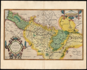
Picardiae Belgicae regionis descriptio.
$300.00
Acquire
- Digital Map Information
- Suitable for large format printing
- Full resolution TIFF file
- ICC color profile embedded
- Delivered instantly via download link
A beautiful example, in superb original color, of Abraham Ortelius' 1579 map of Picardy, the first map of that area in an atlas. The map focuses on the Somme River valley. Amiens, chief city of the region, St. Quentin and La Fere are given particular emphasis. Ortelius' cartouche and scales are embellished with elegant strapwork frames. This specific example is from a 1595 edition of the atlas, and is radiant with the hand color of that period. (more details)
Humorous yet puzzling cartouche.
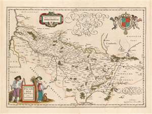
Picardia Regio Belgica, Auctore Ioanne Surhonio.
$300.00
Acquire
- Digital Map Information
- Suitable for large format printing
- DPI: 600
- File Size: 20.02 MB
- File Type: ZIP / TIFF
- ICC color profile embedded
- Delivered instantly via download link
This is Willem Blaeu's map of Picardy, easily the most entertaining map ever produced of this region of northern France. The map focuses on the Somme River valley. Amiens, St. Quentin, and La Fere are given particular emphasis. Putti bear a superb coat of arms with Fleurs-de-lis aloft in the upper right, and the scales are presented in a strapwork frame. (more details)