
Tideman, Philip

Philip Tideman (1657-1705) was a Hamburg-born painter, active in Amsterdam during the Dutch Golden Age. There, he became associated with painter Gerard de Lairess, in whose work Tideman's compositions sometimes appear. Tideman began to make a name for himself with his allegorical paintings with which he decorated the homes of many of the important men; these have been captured in de Lairess' paintings of those spaces. Tideman also partnered with engraver Gilliam van der Gouwen 1650-1720), who committed Tideman's images to print. Their partnership extended to maps, for example in the allegorical cartouches featured on many of the maps printed by Carel Allard.
Glorious Revolution.
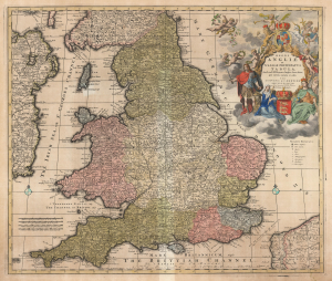
Regni Angliae et Walliae Principatus Tabula, divisa in LII Regiones, Anglice Shire dictas, prae coeteris correcta et edita per I. Covens et C. Mortier Amstelo-Batavum.
$650.00
Acquire
- Digital Map Information
- Suitable for large format printing
- DPI: 600
- File Size: 68.76 MB
- File Type: ZIP / TIFF
- ICC color profile embedded
- Delivered instantly via download link
This is Carel Allard's 1697 map of England and Wales, in its 1725 Covens and Mortier edition. Between the superb engraving of the map and its ornate cartouches, it is one of the most richly decorative maps of England produced in that era. (more details)