
Varlé, Peter Charles

Peter Charles Varlé (also known as Charles Peter Varlé (c. 1770 - 1835) was a French draughtsman, cartographer, and engineer active in the United States. He was born in toulouse in southern France and left France for Hispaniola (Santo Domingo) at the beginning of the French Revolution. He lived on Hispaniola and worked as an engineer until 1794, when he was forced to flee by the uprising of 1794. He moved to the United States and published a renowned plan of Philadelphia in 1796, along with a second edition in 1802. Varlé lived in Maine in 1795, and later in Massachusetts. He again lived in Philadelphia from 1797-98, and then moved to Baltimore, where he spent the rest of his days, except for time spent in Philadelphia in 1802.
The founding of the Republic of Texas.
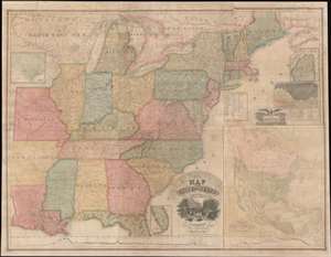
Map of the United States with the Recent Counties, Cities, Villages and Internal Improvements in the Western States.
$7,500.00
Acquire
- Digital Map Information
- Suitable for large format printing
- DPI: 600
- File Size: 209.92 MB
- File Type: ZIP / TIFF
- ICC color profile embedded
- Delivered instantly via download link
An impressive 1836 Phelps and Squire map of the United States with an inset of the newly formed Republic of Texas. This map is a much revised and updated variant on the 1817 Varlé map, and more specifically, the 1832 Stebbins / Varlé reissue. It stands out for its inclusion of the Republic of Texas as an inset - the Republic was declared shortly before this map was published. The map also illustrates U.S. claims to British Columbia - part of the Oregon Question or 54-40 border debate between the United States and British North America. (more details)
Features the Republic of Texas.
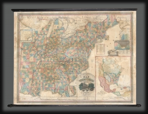
Map of the United States with the Recent Counties, Cities, Villages and Internal Improvements in the Western States.
$3,500.00
Acquire
- Digital Map Information
- Suitable for large format printing
- DPI: 600
- File Size: 199.26 MB
- File Type: ZIP / TIFF
- ICC color profile embedded
- Delivered instantly via download link
An impressive 1845 Phelps and Ensign map of the United States with an inset of the newly formed Republic of Texas. This map is a much revised and updated variant on the 1817 Varlé map, and more specifically, the 1832 Stebbins / Varlé reissue. It stands out for its inclusion of the Republic of Texas as an inset. The map also illustrates U.S. claims to British Columbia - part of the Oregon Question or 54-40 border debate between the United States and British North America. (more details)