
Vogt, Charles H.

Charles H. Vogt (1823 - 1895) was a Prussian-American lithographer active in Cleveland, Ohio from about 1870 to 1889. Vogt was born Prussia and immigrated to the United States in c. 1860, settling in Iowa. He was established as a lithographer of American city views Davenport, Iowa during the 1860s, then in Milwaukee from 1870 to 1879, then in Cleveland, Ohio, from 1879 to 1889. Vogt worked with his son, Gustav. H. Vogt (c. 1858 - July 12, 1936).
Hat Making Capital of the World.
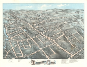
View of Danbury Conn. 1875.
$2,500.00
Acquire
- Digital Map Information
- Suitable for large format printing
- File Size: 42.16 MB
- File Type: ZIP / TIFF
- ICC color profile embedded
- Delivered instantly via download link
This is a striking 1875 O. H. Bailey chromolithograph bird's-eye view map of Danbury, Connecticut, 'Hat Capital of the World'. (more details)
Home of the 'Lowell Mill Girl'.
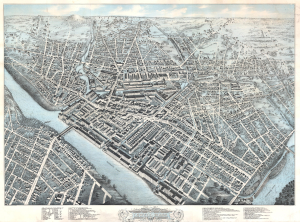
Bird's Eye View of Lowell, Mass.
$1,900.00
Acquire
- Digital Map Information
- Suitable for large format printing
- File Size: 135.63 MB
- File Type: ZIP / TIFF
- ICC color profile embedded
- Delivered instantly via download link
This is a 1876 Howard Heston Bailey and James Hazen bird's-eye view map of Lowell, Massachusetts. Bailey and Hazen present Lowell, then a major industrial center, in impressive detail. The map captures Lowell's Gilded Age heyday as one of the most prominent industrial cities in the United States and a symbol of early American manufacturing power. (more details)
New Bedford's Transformation from a Whaling Town to a Mill City.
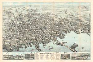
View of the City of New Bedford, Mass. 1876.
$2,200.00
Acquire
- Digital Map Information
- Suitable for large format printing
- File Size: 71.77 MB
- File Type: ZIP / TIFF
- ICC color profile embedded
- Delivered instantly via download link
This is the 1876 first state of Oakley Hoopes Bailey chromolithograph bird's-eye view of New Bedford, Massachusetts. The view captures New Bedford as it transitioned from a wealthy whaling town to a wealthy mill town. (more details)
America's first planned industrial city.
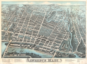
Lawrence, Mass.
$2,000.00
Acquire
- Digital Map Information
- Suitable for large format printing
- File Size: 150.77 MB
- File Type: ZIP / TIFF
- ICC color profile embedded
- Delivered instantly via download link
A striking 1878 two-color chromolithograph bird's-eye view of Lawrence, Massachusetts, by Howard Heston Bailey and James Hazen. The view depicts Lawrence roughly 20 years after its founding. The rigid urban layout, spacious public common, and riverfront industry underscore that Lawrence was the first planned industrial city in the United States. (more details)
Locates mills, paper factories, and the public school.
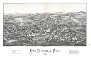
Easter Pepperell, Mass. 1886.
$950.00
Acquire
- Digital Map Information
- Suitable for large format printing
- File Size: 26.65 MB
- File Type: ZIP / TIFF
- ICC color profile embedded
- Delivered instantly via download link
This 1886 Lucian Rinaldo Burleigh bird's eye view map of East Pepperell, Massachusetts provides a look at a modern-day community near the end of the 19th century. Overlooking East Pepperrell from the southeast, several roads that still exist in town are illustrated and labeled, including Groton Street, Leighton Street, Mill Street, Tucker Street, and Hollis Street. Both the Nissitissit and Nashua Rivers are illustrated, and the Pepperell Covered Bridge across the Nashua River is illustrated to the right of center. Seventeen locations throughout town are numerically identified and correspond to an index below the bottom border, including several mills, two paper companies, the post office, train station, and public school. (more details)